The Ultimate Guide to Aspen Summer Adventures

Image: daniel bayer
Aspen’s no place to sit still—not with a plethora of mountains in every direction, biking trails and routes so good they’ve earned special recognition, and rivers and lakes perfect for paddling. Meanwhile, 36 miles of the Fryingpan and Roaring Fork rivers are designated Gold Medal waters, making the area flyfishing heaven. How to make a game plan amid all this abundance? We’ve done the work for you, highlighting top trails to hike or bike, the best boating options, great spots to cast a line, and, as a finishing touch, where to soak in healing hot springs so you’re set to continue adventuring the following day.
Adventures Awaits
In the Alpine | On Water | On Wheels

Adventures in the Alpine
You could spend weeks exploring the hiking trails and peak climbs around Aspen. Want to sit by a high-alpine lake embraced by craggy peaks? Check. Hoof it up a high-mountain pass? Check. Hike through fragrant forest, alongside rushing streams, or in meadows teeming with wildflowers? All of those are available. Or maybe you’ve read about the famed Four Pass Loop or the hike connecting Aspen and Crested Butte. Find information on all these options, and more, here.
Trails For Lake Lovers
Grizzly Lake Trail
The lake lies in a high-alpine basin below the toothy summit of 13,988-foot Grizzly Peak. Begin at 10,560 feet and wind through subalpine spruce to a high valley flush with wildflowers in midsummer. The jagged summits and ridges of the Collegiate Peaks Wilderness form an impressive backdrop as you ascend to a broad shelf covered with scrubby, gnarled krummholz. One final, long switchback leads you to the rocky lakeshore, where turquoise waters lap.
Length: 7.2 miles round-trip
Difficulty: Moderate
Get There: High-clearance vehicle required. Drive 11 miles east of Aspen on Highway 82 to Lincoln Creek Road. Continue for 6.1 miles on Lincoln Creek to the trailhead on the left, just after Grizzly Reservoir.
American Lake and Cathedral Lake/Electric Pass
Though reached via separate trails, this pair of nearby high-mountain lakes are two of the most popular hikes near Aspen. On weekend mornings, the trailhead parking areas fill by 8 a.m. For both hikes, begin by ascending through aspen groves (a blaze of gold in the fall). Weave in and out of forest and meadows on the approach to American Lake, which shimmers emerald in sunlight.
The trail to Cathedral, meanwhile, parallels Pine Creek high above on a wide ledge, then follows eight short but steep switchbacks before the final push to the lake, ringed by an amphitheater of craggy summits. Extra credit for hearty hikers: From Cathedral, push on another 1.8 grueling miles to 13,500-foot-high Electric Pass, Colorado’s highest trail pass (and, yes, prone to lightning strikes); the view across the Conundrum Creek Valley toward Pyramid Peak, the Maroon Bells, and Snowmass Mountain is suitably breathtaking.
Length: 6.4 miles round-trip (American); 5.6 miles (Cathedral); 9.6 miles (Electric Pass)
Difficulty: Moderate+
Get There: For American Lake, drive Castle Creek Road for 10 miles from the Aspen roundabout to the trailhead turnoff on the right (American); continue another 2.2 miles farther for Cathedral.
Linkins Lake
A short but fairly steep trail leads to this small lake nestled at 12,000 feet in elevation within a glacial cirque. Soak in the up-close views of the Continental Divide as you catch your breath. The terrain is above tree line, and in midsummer, a bounty of wildflowers lines the route.
Length: 1.2 miles round-trip
Difficulty: Easy to moderate
Get There: Drive 18.5 miles east of Aspen on Highway 82 to trailhead parking on the left.
Crater Lake
Beyond Maroon Lake lies this picturesque destination, seemingly dwarfed by 14,014-foot North Maroon Peak rising above it. The trail winds through quaking aspen groves and, after a few steep spurts, across a boulder field en route to the lake.
Length: 3.6 miles round-trip
Difficulty: Moderate
Trailhead: For required trailhead parking or shuttle bus reservations at the Maroon Bells Scenic Area, check visitmaroonbells.com.
Trails For Families
Weller Lake
With minimal elevation gain and a lake at the end, below a cirque of craggy peaks, this hike has a big payoff. Afterward, consider a side trip to the Grottos day-use area, less than a mile farther east, where a series of short trails leads to waterfalls, ice caves, and cool rock formations.
Length: 1.2 miles round-trip
Difficulty: Easy
Get There: Drive 9 miles east of Aspen on Highway 82 to the trailhead on the right (just before Weller Campground).
Ditch Trail
This mellow trail begins by traversing the lower slopes of Snowmass ski area, then parallels an old irrigation ditch through shady aspens. The farther you go, the bigger the views of Mount Daly and the Snowmass Creek Valley. The trail ends near a junction with the East Snowmass Creek Trail.
Length: Up to 3.2 miles round-trip
Difficulty: Easy
Get There: Drive Divide Road in Snowmass Village to Pinon Drive on the left; trailhead parking is on the right. Or hike from the top of Carriage Way near the Snowmass Mall via Sleigh Ride Trail, about .75 miles each way.
Savage Lakes
With roughly 1,200 feet of elevation gain, this is a great day trip for more intrepid and fit hikers. The rocky trail switchbacks, somewhat steeply at first, through dense spruce. The forest opens as you approach the lakes. At approximately 1.6 miles, you’ll meet lake number one. Look for cairns on the left that mark the way to the upper lake.
Length: 4 miles round-trip
Difficulty: Moderate
Get There: Drive 25 miles from Basalt up Frying Pan Road to Meredith. About 3 miles farther, turn left on Forest Road 501. One mile after Elk Wallow Campground, take the left fork and drive 3.25 miles to the trailhead on the left.

Image: daniel bayer
Lost Man
From the upper trailhead, gradually ascend alongside Upper Roaring Fork Creek; the multipeaked ridgeline of Geissler Mountain borders on the left while Twining Peak rises to the right. The reward for climbing? The shimmering waters of Independence Lake. Continue to a rocky saddle at 12,800 feet, with a view of the lush Lost Man Valley below. Descend into the basin, passing Lost Man Lake, then hike through a marshy valley carpeted with wildflowers. Soon after Lost Man Reservoir, you’ll arrive at the lower trailhead.
Length: 8.8 miles point to point
Difficulty: Moderate
Get There: See Linkins Lake access. Or hike in reverse, starting at the trailhead 14 miles east of Aspen on the left. Leave another car at one of the trailheads to shuttle at the end of the hike or try your luck at thumbing a ride back to your vehicle.

Image: daniel bayer
Trails For Peak Baggers
Capitol Peak
The Elk Mountains are home to seven fourteeners (peaks that rise above 14,000 feet) that collectively might be the hardest to climb in Colorado, and Capitol Peak is considered the most difficult, thanks in part to its notorious knife-edge ridge and extreme exposure. For experienced and properly equipped alpinists who know the precautions to take in high-alpine, high-altitude technical terrain (and understand and accept the potentially fatal consequences of this unforgiving route) the 14,279-foot summit pays huge dividends in views, adrenaline highs, and eye-popping images for social media feeds. Everyone else: Consider Castle or Tabor Peak, and if you still want to give Capitol Peak a go, hire a professional, certified guide from Aspen Expeditions.
Length: 16 miles round-trip
Difficulty: Extreme/experts only
Castle Peak
A trail in the basin leads to Castle’s rocky northeast ridge. From there, the hike to the summit is straightforward, with only a few tricky spots to negotiate.
Length: Up to 10 miles round-trip and up to 4,500-foot elevation gain
Difficulty: Strenuous
Get There: The route begins on the jeep road that leads to Montezuma Basin at the end of the Castle Creek Valley. Lower-clearance vehicles should park roadside near the bottom; four-wheel-drive vehicles might make it up to a parking area at about 12,800 feet.
Tabor Peak
Hike across Lincoln Creek (it may be difficult to ford during early-summer runoff). Continue along the trail to access the lake, a spectacular high-alpine tarn reached by bushwhacking uphill to the right, just beyond the fourth large meadow you’ll hike through. From the lake, scramble up to the peak’s north ridge. The final stretch to the 13,282-foot summit—some rock scrambling may be necessary—is breathtaking.
Length: 6.7 miles round-trip, with 3,100 feet of elevation gain
Difficulty: Strenuous
Get There: High-clearance vehicle required. Drive 11 miles east of Aspen on Highway 82 to Lincoln Creek Road. Continue for 4.1 miles on Lincoln Creek to the marked turnoff on the right.
For Backpackers
For wilderness solitude, we recommend the pleasure of consulting the map and plotting out your own routes on existing trails. That said, Aspen has two iconic overnight hikes, each spectacular and so popular that advance permits, which book up quickly, are necessary.
Four Pass Loop
This renowned route, which circumnavigates the Maroon Bells, has it all: jaw-dropping scenery; views for miles and miles; more wildflowers than you’ve likely seen; rushing streams and glistening lakes; and four lung-busting mountain passes, each above 12,400 feet in elevation. To revel in all this splendor, you must buy a camping permit in advance and store food and toiletries in a bear canister. Most backpackers complete the loop in four days.
Length: 26 miles
Difficulty: Strenuous
Get There: The loop begins and ends at the Maroon Bells Scenic Area at the end of Maroon Creek Road. For required trailhead parking or shuttle bus reservations, go to visitmaroonbells.com.

Bonus hike for Backpackers
Conundrum Hot Springs
Few things are nicer than a soak in steamy water after a long hike. These natural hot springs pools at trail’s end are so well loved that you’re required to reserve one of 20 backcountry campsites (recreation.gov) to overnight there (bear canisters also required). Though long, the trail ascends gradually through an incredibly scenic valley, crisscrossing Conundrum Creek, while the springs themselves lie below Castle Peak and Triangle Pass. Note: Dogs are not allowed past Silver Dollar Pond along the trail.
Length: 17 miles round-trip
Difficulty: Moderate
Get There: Drive Castle Creek Road for 5 miles from the Aspen roundabout to Conundrum Creek Road on the right, then follow it for another mile to road’s end.
Know Before You Go
- Get a map. Visit an outdoors store like the Ute Mountaineer (210 S Galena St) and ask for recommendations, and/or download trail info.
- Have a plan. Tell somebody where you are going and when you expect to be back.
- Start early. Brief afternoon thunderstorms commonly occur in the summer, so allow plenty of time to get down from peaks or exposed ridges before a storm hits.
- Temper your objective. The air is thin up here, and altitude impacts even the fittest lowlander. Take a couple of shorter hikes closer to town before setting out on a high-alpine adventure.
- Prep for cooler temps. The higher you go, the colder it can get, even in the middle of summer, so pack a lightweight fleece along with your rain jacket.
- Pack the essentials. Even on the shortest hike, always carry a cell phone with a backup battery, a headlamp (in case your hike takes longer than expected), extra layers, and more water than you think you might need.
- Know how to get help. Aspen’s all-volunteer search and rescue team, Mountain Rescue Aspen, never charges for its services; call or text 911 if you have an emergency, the sooner the better.
$plurge Hike
Hiking 3,200 feet up Aspen Mountain is an accomplishment worth celebrating. The Aspen Collection’s Trek at Buckhorn provides all the elements for an elevated fete, beginning with a guide to accompany you on the ascent, sharing knowledge on local plants and wildlife. Then enjoy a customized, chef-prepared lunch al fresco by the historic Buckhorn Cabin, with mountain views for miles. Don’t worry about tired legs or imbibing too much wine; the trek finishes with a Jeep ride back down the mountain. $6,000 plus $500 minimum per person, for up to 22 guests.
For Explorers
One of Aspen’s most beloved summer adventures, the hike to Crested Butte through the heart of the rugged Elk Mountains is a stunner. The shortest and most popular route, 11 miles, starts at Maroon Lake and goes over 12,490-foot West Maroon Pass. A less-traveled and less-steep—though longer—option is the 16-mile route that combines the East Maroon Trail over 11,824-foot East Maroon Pass and the Copper Creek Trail. Rarely traveled is the 17.5-mile epic route up the Conundrum Creek Trail, over 12,900-foot Triangle Pass, and down the Copper Creek Trail. Then spend a night (or two) in the charming town of Crested Butte. To get from the trail’s end into Crested Butte, reserve a ride with Dolly’s Mountain Shuttle or Alpine Express. Hike back to Aspen, rent a car, or book a private shuttle.
For Daytrippers
Getting in a hike before or after work, or even during lunch, is a regular part of many locals’ summer schedule. In Aspen, popular options include the short, ultra-steep Ute Trail up lower Aspen Mountain; the unpaved road up Smuggler Mountain; the boulder-strewn lower Hunter Creek Trail; and a portion of the south-facing Sunnyside Trail on lower Red Mountain. In Snowmass Village, the Rim Trail South to the yin-yang overlook and the shady Tom Blake Trail below the ski area are go-tos. aspenrecreation.com/parks-trails, hike.

Image: chris council/c2photography
Adventures on Water
Thanks to its numerous alpine lakes and reservoirs, natural hot springs, and the Roaring Fork and Fryingpan rivers, the Aspen area offers plentiful options for water enthusiasts, whether it’s standup paddleboarding (SUP), rafting, kayaking, fishing, or soaking in geothermally heated pools. Here are some of our favorite ways to enjoy the water and the Rocky Mountain scenery.
Standup Paddleboarding
Stillwater/North Star Nature Preserve
Just east of Aspen, the gentle three-mile section of the Roaring Fork River known as Stillwater is certainly scenic—and likely the most popular paddling destination in the valley. For essential info on where to park, put in, and take out, go to pitkincounty.com/1534/North-Star-Aspen. Or book a shuttle ride with a local guide service (see SUP Resources).
Ruedi Reservoir
This thousand-acre lake 15 miles up the Fryingpan Valley from Basalt hosts all manner of water-based recreation, including motorized boating, sailing, and paddleboarding. Park and launch from the main boat ramp near the dam (a no-wake zone), from Freeman Mesa about halfway up the lake, or from the Dearhamer Campground day-use area at the reservoir’s narrow east end (fee required).
Chapman Reservoir
With 83 sites in an adjacent campground, gentle water, and open views across the Fryingpan River valley, Chapman is a much-loved family destination. There’s also a day-use area (fee required) if you’re only coming up to paddle. The lake is 29 miles east of Basalt, past Ruedi Reservoir.
Dinkle Lake
This small reservoir near the base of massive Mount Sopris is well-frequented by paddleboarders on weekends and summer afternoons. Two lakeshore parking areas accommodate vehicles and high-clearance is recommended for the final, bumpy couple of miles to the lake. Access it from either Carbondale or Basalt; the lake is shortly after the Thomas Lakes/Mount Sopris trailhead.
Roaring Fork River (Pink to Black)
Named after the color of the bridges at each end, this sun-soaked, seven-mile stretch of moving but relatively mellow water with small waves and one Class II rapid is perfect for intermediate paddlers. Put in at the boat ramp off Highway 82, just downstream of Highway 133, and take out at Westbank (County Road 109).
SUP Resources
- Aspen Kayak & SUP (970-618-2295, aspenkayakacademy.com) for lessons and Stillwater shuttle
- Aspen Whitewater Rafting (970-920-3511, aspenwhitewater.com)
- Blazing Adventures (970-923-4544, blazingadventures.com) for trips, rentals, and Stillwater shuttles
- Elk Mountain Expeditions (970-456-6287, elkmtnaspen.com) for rentals including Stillwater shuttle
- Thunder River Adventures ( 970-452-7960, thunderriveradventures.com) for rentals and trips, including Stillwater
- Shaboomee (970-315-2224, shaboomee.com) for rentals, sales, repairs, trips, and instruction

Image: jordan curet
Rafting/Kayaking
From its headwaters near Independence Pass to its confluence with the Colorado River in Glenwood Springs, the Roaring Fork River drops more than 6,000 feet over 70 miles. This means plenty of whitewater for boating. Local raft companies put their most experienced guides on Slaughterhouse, a fast and furious stretch of river—dropping 85 feet per minute on average—that starts just outside Aspen and includes multiple Class IV and V rapids.
A few notches lower on the thrill meter, the upper Roaring Fork through Woody Creek and Snowmass canyons is the valley’s most popular commercial trip, featuring exciting Class III rapids spelled by calmer stretches. A tamer option is the middle and lower Roaring Fork, with just enough splash to stay cool on a hot summer’s day and plenty of time to soak in the sights and sounds of the river. Experienced kayakers can practice spins, flips, and surfing (and spectators can gawk) at the Glenwood Whitewater Park, while the Healthy Rivers Whitewater Park on the Roaring Fork just above Basalt has two wave features.
Paddling Resources
Aspen Whitewater Rafting, Blazing Adventures, Elk Mountain Expeditions, and Thunder River Adventures all offer varying menus of rafting and inflatable kayak (ducky) trips on the Roaring Fork, as well as on the nearby Colorado and Arkansas rivers. (See SUP Resources for contact info.)
New whitewater kayakers should enlist the help of Aspen Kayak & SUP, starting with a pool session at the Aspen Recreation Center and followed by a guided river trip.
$plurge Float Trip
Feast on lunch or dinner outdoors after rafting the middle section of the Roaring Fork River with Thunder River Adventures’ Float to Table trip. After bobbing through gentle rapids, take out near Carbondale at a private and secluded riverside ranch to savor a meal cooked by a personal chef over an open fire (think ribeye, beef tenderloin, and veggies, though custom options are also available). Drinks are BYOB, but they will be shuttled to the ranch, along with dry clothing for you to change into. Linger by the fire or cozy up in a glamping-style tent with a wood-burning stove before being chauffeured back to your accommodations. $1,800 total for lunch, up to six people; $2,600 total for dinner, up to six people. Inquire for additional guests.

Image: ross kribbs
Flyfishing
Fryingpan River Below Ruedi Reservoir Dam
Colorado’s fattest brown trout, as large as eight or more pounds, inhabit the two miles of the Fryingpan below the dam. But hooking these fish—let alone landing one—is notoriously difficult. They’re extremely leader-shy and will avoid any kind of visible flash from the line. Ruedi Reservoir itself is best for boat fishing, and you can land some biggies, including kokanee salmon.
Rio Grande Trail Along the Upper Roaring Fork River
Start at the John Denver Sanctuary in Aspen and cast into the pools behind this stretch’s big boulders. Then walk downstream on the paved Rio Grande Trail to access more pocket water.
Lower Roaring Fork River
The stretch from Carbondale to Westbank or Glenwood Springs is the summer’s go-to run for many local anglers. The appeal? Variety. Everything from green drake nymphs and streamers to dry flies and terrestrials can tempt this river’s trout. On July evenings during this river’s beloved green drake hatch, fishing guides float this section for an after-hours party that doesn’t dwindle until dark.
Crystal River Above Carbondale
The Crystal River, a freestone stream that tumbles out of the Elk Mountains to join the Roaring Fork at Carbondale, has fewer (and smaller) fish than its neighboring, better-known rivers. But they’re lively eaters. Park at the Crystal River Hatchery south of downtown Carbondale off Highway 133 and fish up- and downstream of the bridge. For a more backcountry feel, drive upstream beyond Redstone and park in one of the pull-offs to fish this river’s glimmering riffles and undercut banks. Aim for a Colorado grand slam of cutthroat, brown, rainbow, and brook trout.
Maroon Lake
The lake, a centerpiece of the Maroon Bells Scenic Area near Aspen, holds sizable populations of stocked rainbow and brook trout (for required shuttle bus reservations: visitmaroonbells.com). Trophy-size fish may be hard to catch midsummer, but smaller trout remain willing (often eager) to munch anglers’ lures.
Grizzly Lake
Colorado’s native cutthroat trout inhabit this mountain-framed lake at a lofty 12,520 feet (see “Trails for Lake Lovers”). At such high elevations, food is scarce for more than half the year, so fish eagerly gobble what anglers offer—provided you don’t spook them with your approach.
Fyfishing Resources
Aspen outfitters that offer guided wade and float trips:
- Aspen Flyfishing (970-920-6886, aspenflyfishing.com)
- Aspen Outfitting (970-925-3406, aspenoutfitting.com)
- Aspen Trout Guides (970-379-7963, aspentroutguides.com)
- Trout Belly Anglers (970-615-0874, troutbellyanglers.com)
- Wild Willow Outfitters,(970-710-2685, wildwillowoutfitters.com).
In Basalt:
- Fryingpan Anglers (970-927- 3441, fryingpananglers.com)
- Taylor Creek Fly Shop (970-927-4374, taylorcreek.com).

Soaking
Glenwood Hot Springs Resort
Dating to 1888, the resort’s centerpiece is the world’s largest hot springs pool, including lap-swimming lanes and a diving board. But that’s not all. There’s also a 104-degree pool purely for soaking and, opened in 2024, the Yampah Mineral Baths—three smaller hot pools and two cold plunges. From Memorial Day to Labor Day, the Sopris Splash Zone includes an “adventure river” tubing ride and a kids’ play area with mini-slides, gentle waterfalls, and a splash pad that morphs into a lighted fountain at night.
Iron Mountain Hot Springs
On a south-facing bank of the Colorado River in Glenwood Springs, the resort has two groupings of geothermal pools: 16 of the pools (including a large, freshwater family pool) are open to all ages. Guests 21 and older can upgrade to the WorldSprings section, where the mineral content in each of 11 pools replicates hot springs from a different country, and a cold plunge and freshwater pool also await. Purchase tickets in advance for designated time slots.
Avalanche Ranch
Tucked away in the Crystal River Valley near Redstone, beloved Avalanche Ranch offers rustic log cabins and a blissful series of tiered hot springs pools, as well as a cold plunge tub. Hot springs access is included for overnight guests; day visitors must reserve morning or afternoon slots.
Penny Hot Springs
These relatively undeveloped natural springs lie about 15 minutes south of Carbondale off Highway 133 (near mile marker 55 ). From the parking area, clamber down the riverbank to a handful of pools separated from the cold Crystal River by large rocks.
Adventures on Wheels
The Roaring Fork Valley’s cycling scene offers great variety, from easy bike path riding and flowy dirt trails to challenging road rides and technical mountain bike routes. It all adds up to Colorado’s only Gold-Level Ride Center, a designation from the International Mountain Bicycling Association that distinguishes an area for its wide range of trails, cyclist amenities, and community support. Here are just some of the reasons for that recognition.
Road Biking, E-Biking & Gravel Biking
Rio Grande Trail
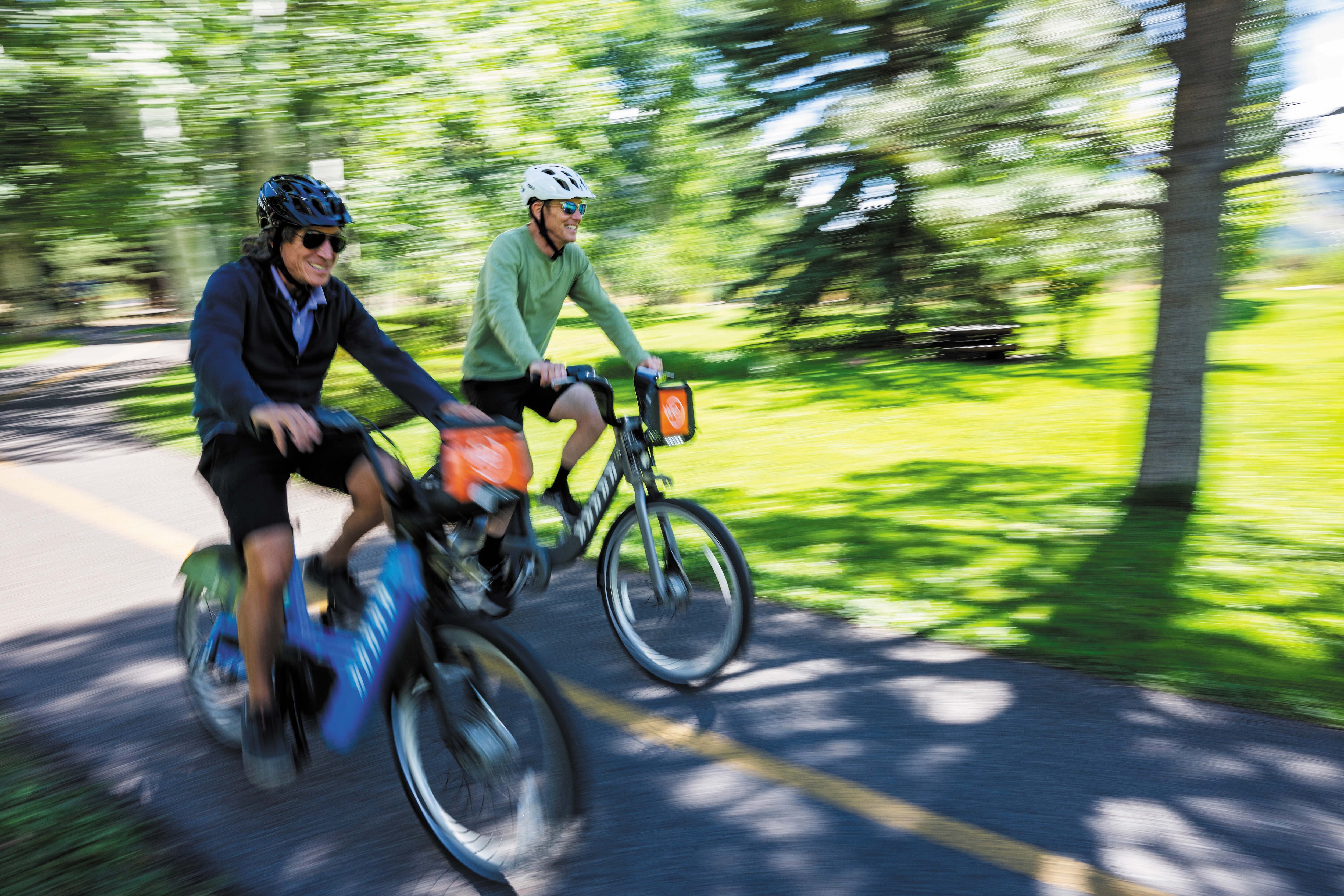
This primarily paved, multi-use trail follows a former railroad bed from Glenwood Springs to Aspen. Covering 42 miles, the path ascends 2,100 feet upvalley from Glenwood—mostly alongside the Roaring Fork River—but the grade rarely exceeds 3 percent. Gravel riders can use the unpaved shoulders and occasional side paths. Ride for as little or as long as you want; there are numerous possible entries and exits, and you can always return on a bike-rack-equipped Roaring Fork Transit Authority bus. One of the most popular sections (16 miles round-trip) runs from Aspen to the Woody Creek Tavern, a convenient spot for refreshment.
Length: Up to 42 miles
Difficulty: Easy
Good for: Road bikes, e-bikes, gravel bikes
Get There: From downtown Aspen, head north on Mill Street, then left on Puppy Smith to access the trail across from the post office.
East of Aspen Trail
This relatively flat route—which begins as a paved path from town, then turns to gravel at Stillwater—travels along the Roaring Fork River and the edge of the North Star Nature Preserve to Difficult Campground. About halfway through, look for the J.H. Smith Interpretive Loop, where you can lock up your bike and stroll through lush wetlands, learning about local flora and fauna via trailside signs. Also, look for moose who feed on the nearby willows.
Length: 6 miles round-trip
Difficulty: EasyGood for: E-bikes, gravel bikes
Get There: Pedal east from downtown Aspen on the paved path, turn right on Stillwater, and pick up the trail on the left.

Image: karl wolfgang
Maroon Creek Road
With limited access to vehicles, lofty scenery that unveils itself around each bend, and a photogenic finish at Maroon Lake, below the 14,000-foot Maroon Bells, this is one of the valley’s most popular bike routes. The final mile or so of the 1,600-foot climb can be a grunt. Keep in mind that buses regularly bring visitors to the Bells, so stay right on the road (even as you see other cyclists defy the rules and ride several abreast).
Length: 23 miles round-trip
Difficulty: Moderate to difficult
Good for: Road bikes, e-bikes
Get There: From downtown Aspen, follow the bike route along W Hopkins Avenue, across the Marolt Open Space, and over to Maroon Creek Road. Alternative: For a shorter ride, begin at Aspen Highlands, where there is paid parking (and bike rentals).
Castle Creek Road to Ashcroft
Less trafficked and equally as scenic as riding to the Maroon Bells, this paved road climbs some 1,800 feet up the Castle Creek Valley, offering striking views of the surrounding peaks and a dose of history at the silver-mining ghost town of Ashcroft. Bonus: Ride another mile past Ashcroft to the Pine Creek Cookhouse for lunch (reservations a must) before descending.
Length: 28 miles round-trip
Difficulty: Moderate to difficult
Good for: Road bikes, e-bikes
Get There: From downtown Aspen, follow the bike route along W Hopkins Avenue and across the Marolt Open Space; turn left onto Castle Creek Road.
Old Snowmass–Sopris Creek–Emma Loop
This route offers quiet roads, 1,000 feet of undulating climbs and descents, and million-dollar views of Capitol Peak and Mount Sopris. Ride up Snowmass Creek Road. Turn right at the T-intersection, then turn right again onto East Sopris Creek Road. After a steady climb, the road turns to smooth gravel for a few miles, then back to pavement. At the intersection with Sopris Creek Road, go right, then pick up the Rio Grande Trail by the old schoolhouse in Emma. Pedal on the paved path for 5.5 miles back to the start.
Length: 15-mile loop
Difficulty: Moderate
Good for: E-bikes, gravel bikes
Get There: From Aspen, drive or ride the bus to the park and ride lot at the corner of Highway 82 and Snowmass Creek Road, across from the Conoco.
Lenado
Ride pavement for the first stretch as the road winds by farms and ranches. The surface turns to gravel at almost five miles, and the valley starts to narrow. By the time you reach the small settlement of Lenado, you’ll have gradually climbed some 1,500 feet. This is an especially beautiful ride in the fall, when large swaths of golden aspens blanket the hillsides along the road.
Length: 17 miles round-trip
Difficulty: Moderate
Good for: E-bikes, gravel bikes
Get There: Park at the intersection of Upper River Road and Woody Creek Road (the Woody Creek trailhead) or ride the Rio Grande Trail from Aspen (an additional 7.5 miles each way).

$plurge E-bike Ride
The Little Nell
What better reward for cycling up the stunning Castle Creek Valley—in addition to jaw-dropping views, that is—than a gourmet meal? The Little Nell’s Ride and Dine Series (July 16 & 29, Aug 12) features a guided e-bike ride to the Aspen Center for Environmental Studies (ACES) newly renovated Catto Center at Toklat, where a multicourse feast prepared by Little Nell chefs (with pairings by the hotel’s renowned wine team and special guest vintners) awaits. As the ride climbs 1,600 feet over 12 miles to the Ashcroft Valley, e-bikes are recommended (and can be rented from Aspen Collection next to The Little Nell), as is a change of clothes, which the hotel will transfer to Toklat. The evening also includes a short history tour with an ACES guide, live music, and a post-dinner shuttle back to the hotel for guests and bikes. Price is $400 per person (includes tax and gratuity); wine pairings are an additional $100 flat fee.
Mountain Biking
Aspen Smuggler Mountain/Hunter Valley Trail Network
The 1.4-mile, 845-foot climb up Smuggler on a rocky jeep road is no picnic, especially in warm temps, but the reward is access to a bounty of former mining roads and old-school technical trails—rocky, rooty, and demanding of focus—on both sides of the Hunter Creek Valley. Plus, the mountain views are amazing, and in midsummer the wildflowers are abundant.
From the base of Smuggler Mountain Road, ascend the jeep road to the Smuggler Observation Deck; after ogling the view, continue climbing up BTS (Behind the Sign) Trail to Tootsie Roll to Lollipop, then descend to Iowa Shaft into the valley. Or from the Smuggler Observation Deck, ride the Hunter Creek Cutoff to the valley floor and climb up the other side to the intersection known as Four Corners to access routes like the Hobbit Trail, Secret Trail, Upper and Lower Plunge, and Hummingbird Trail. When you’re finished exploring, ride the very rocky Hunter Creek Trail (watch for hikers!) out to the paved Red Mountain Road and cruise down to town. Note: you can start your ride by climbing this same trail into the valley, and there’s a trailhead parking area off Red Mountain Road. Pick your poison.
Length: Varies
Difficulty: Moderate to difficult
Get There: Start at the base of the Smuggler Mountain Road in Aspen.
Snowmass Bike Park
Snowmass Village has become a mountain biking mecca, in part because of the ski area’s on-mountain bike park. Served by gondola and chairlift (ticket required), the park offers 16 purpose-built downhill biking trails. Novice downhill bikers can rack up miles on EZ-PZ and Verde, both flowy trails with relatively smooth surfaces, gentle pitches, and mild berms and rollers. Trails like Lemon and Valkyrie take it up a notch with wooden rollers and medium-size jumps, respectively, while expert freeride descents like Gonzo and Valhalla serve the kind of riders that most of us just marvel at. Clinics and camps for building skills are offered throughout the summer, and downhill and enduro bike rentals are available at Four Mountain Sports in Base Village.
Snowmass Mountain
The ski area has several cross-country mountain bike trails, too, which don’t require lifts to access and can be combined in various loops. Among them, Discovery (uphill only) and Village Bound trails provide a perfect route for novice mountain bikers. Campground Connector and Tom Blake Trail are intermediate heaven and pop with wildflowers in summer. A longtime classic for experienced riders, the Government Trail runs to Aspen, crossing both Snowmass and Buttermilk ski areas and offering technical challenges aplenty.

Image: Daniel Bayer
Rim Trail Loop
snowmass
The route cruises along the high, spiny ridge north of Brush Creek Road with a backdrop of Mount Daly. From the parking lot, climb the paved Brush Creek Trail for almost 2.5 miles to the start of the Rim Trail South. Ascend via smooth switchbacks to the ridge, then enjoy a fast and flowy downhill before a stout climb midway. From the second high point, ride down the Rim Trail North or, for a slightly longer ride, take the turnoff for the Seven Star Trail, one of the best descents in the valley.
Length: 10.6 miles
Difficulty: Moderate
Get There: Start riding from the Rodeo Lot in Snowmass Village.
West Sky Mountain Park Loop
snowmass
This locals’ favorite has breathtaking views of the Brush Creek Valley, including Mount Daly and neighboring Capitol Peak, sustained climbing, and fun downhill with banked turns and optional jumps. Cross under Highway 82, then climb more than 900 feet over 3 miles on Cozyline Trail to the top of the ridge. Cycle south along the ridge on Skyline Trail, alternating fast descents with short, punchy climbs. Look for the downhill directional trail Deadline on the left and let it rip. Ride Highline Trail to Ditch Trail, then descend Brush Creek Road on the paved bike path.
Length: 9.5 miles
Difficulty: Moderate
Get There: Start riding from the Brush Creek parking lot at the intersection of Highway 82 and Brush Creek Road.
Airline Loop
snowmass
This route covers the east side of Sky Mountain Park. Pedal along the mellow Butterline singletrack, which parallels Owl Creek Road, then cross the road and follow the bike path to the start of the Airline Trail. Within a few minutes, start ascending the gently climbing, uphill-only Incline Trail to the ridge top. Soak in the stellar 360-degree mountain views, then turn right on Cozyline and ride a short section before buckling in for a fast, fun ride on the downhill-only Airline Trail, paralleling the private jets landing at the Aspen airport.
Length: About 7 miles
Difficulty: Moderate
Get There: Start from the Buttermilk parking lot.
The Crown
basalt /Carbondale
Ever expanding, this area offers miles of purpose-built bike trails on a sagebrush- and juniper/pinyon–dotted mountain between Carbondale and Basalt. Though it’s easily accessible from those two towns, ride just a few miles and you’ll feel like you’re much farther away. On the Basalt side, the Glassier/Buckhorn Traverse/Buckhorn loop is a favorite among local riders, as is Crown Royale, an expert freeride trail with massive berms and drops. From the Carbondale side, novice to intermediate riders love the flow of trails like Prince Creek, Christmas Tree, and Lower Monte Carlo. Experts find their challenge on trails with huge berms and steep drops like Ginormous and Father of Ginormous. For the ultimate ride, cross over the top of the Crown via Buckhorn/North Porcupine or Imperial Gardens.
Length: Varies
Difficulty: Easy to difficult
Get There: Start riding from the Bullpen parking lot off Prince Creek Road near Carbondale or the lot on Hooks Spur Lane in Basalt.
Summer Cycling Resources
- Aspen’s Best E-Bike Rentals ( 970-710-0603, crownbikerentals.com), e-bike rentals
- Aspen Bikes ( 970-925-9169, aspenbikes.com), e-bike, mountain bike, and road bike rentals
- Aspen Cycle ( 970-920-3664, aspencycle.com), service of all bikes
- Aspen Sports ( 970-925-6331, aspensports.com), e-bike and mountain bike rentals
- Aspen Velo ( 970-925-1495, aspenvelo.com), e-bike rentals
- Basalt Bike and Ski (four locations, cripplecreekbc.com), rentals, sales, and service of all bikes
-
Blazing Adventures ( 970-923-4544, blazingadventures.com),
bike tours - Four Mountain Sports (four locations, aspensnowmass.com), rentals, sales, and service of mountain and e-bikes
- Hub of Aspen ( 970-925-7970), rentals, sales, and service of all bikes
- Maroon Bells Ebikes (maroonbellsebike.com), e-bike rentals
- Ride Aspen ( 970-404-0190, bikerideaspen.com), mobile delivery, rentals, and repair of all bikes
- Silver City Cycles ( 970-973-9454, silvercitycycles.com), mobile delivery e-bike rentals
- Ute City Cycles ( 970-920-3325, utecitycycles.com), sales and service of all bikes
