Aspen Underground
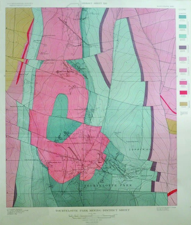
Yesterday’s geological map of the mining areas around Aspen Mountain’s Tourtelotte Park is today’s fine art.
Image: Jay Cowan
It’s hard to imagine that an oversize book of lithographs issued in 1898, titled Atlas to Accompany Monograph XXXI on the Geology of the Aspen District Colorado, would provide some of our most enduring art from mining-era Aspen. But take one look at the braided salmon-reds, golds, and blues of geologic strata that flow across these full-color lithos like riveting color-field abstractions, and their beauty becomes clear. The maps provide glimpses of the geological features under Aspen as well as Aspen Mountain, Smuggler Mountain, Hunter Park, Lenado, and other locations. Part of a collection assembled by late Aspen mining promoter Ed Smart, the maps were primarily acquired from third-generation Aspenite and mining authority Billy Herron.
View them during February at the Woody Creek Community Center, which is hosting a monthlong show of the images along with century-plus-old, one-of-a-kind hand-drawn mining maps from the Aspen area, all framed and for sale ($650–$1,500).