Bonus Runs
You’re skiing down a run or cruising along a catwalk, and a trail sign catches your eye. Having thoroughly studied the trail map, you pause. The name of this run doesn’t sound familiar. Later on, you recheck the map and, sure enough, the trail you passed—or perhaps chose to explore—isn’t on it.
More than at many other ski areas, the four mountains of Aspen Snowmass cache a treasure trove of these signed trails that are not on the map. Some are long runs; others are short shots through a glade of trees or down a pitch of a dozen or so turns. Some of the markers have the same design as all the others on the mountain; others seem handmade. What they all provide is the surprise and delight that comes from discovering something under the radar. Even locals who have skied here for years don’t know about some of these hidden gems.
So why aren’t they on the map? There’s no definitive answer. Some paths may be too short to warrant squeezing onto an already busy map. Some evolved as a tribute to a mountain employee rather than being cut as an “official” trail. And, as Buttermilk Patrol Director Chris Halsey notes, “at some point, we like to leave a little adventure and discovery.”
To be clear, these are not locals’ favorite powder stashes. If we gave up those secrets, we’d be run off the mountain, if not out of town. Neither are they Aspen’s famed shrines, created deep in the trees between trails to honor everyone from Jimi Hendrix and John Denver to locals who passed away, often prematurely. Nor are they for beginner skiers—though a few can be tackled by intermediate skiers, most are for experts only. No, these hidden routes are their own breed. Think about finding them as a sort of on-mountain scavenger hunt.
Here, we highlight some routes at each of Aspen’s four mountains, along with their backstories. Others we’ve left unmentioned, awaiting the moment you may ski by and notice them on your own. That’s the best kind of discovery.
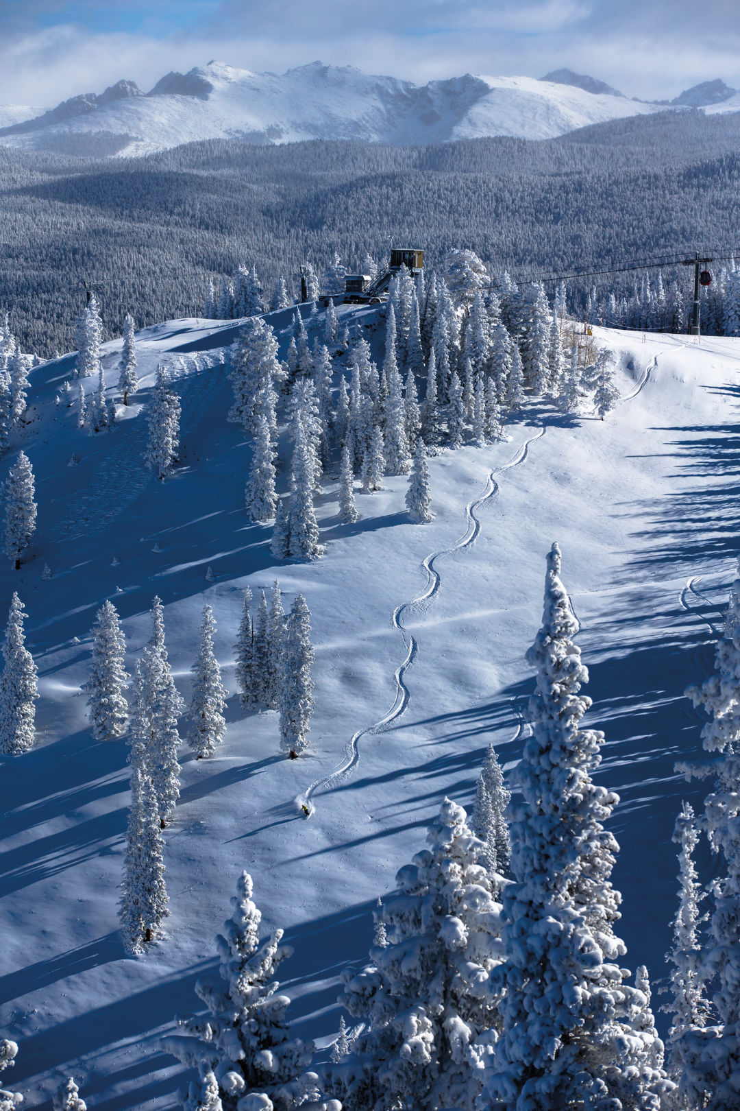
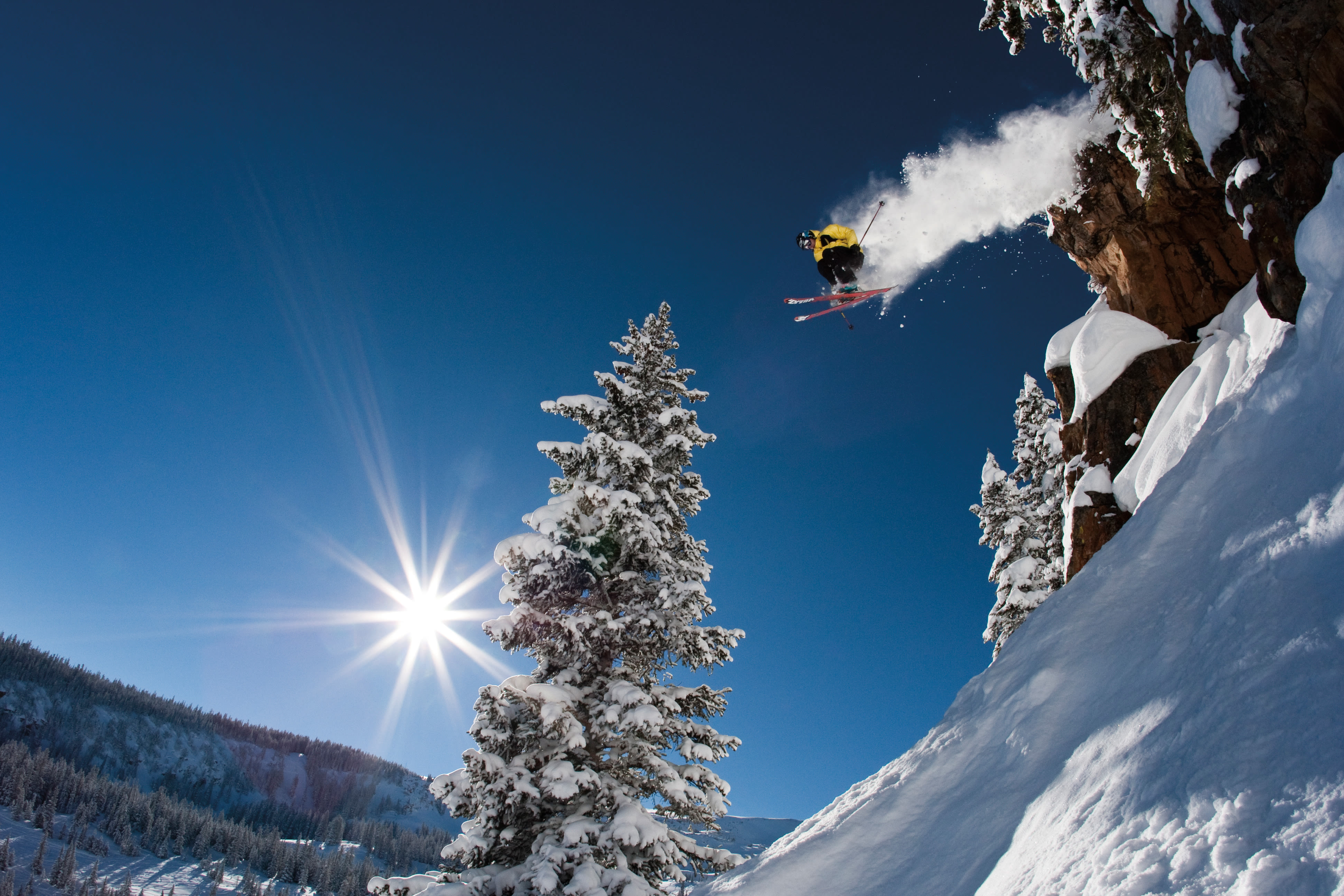
Image: Jesse Hoffman
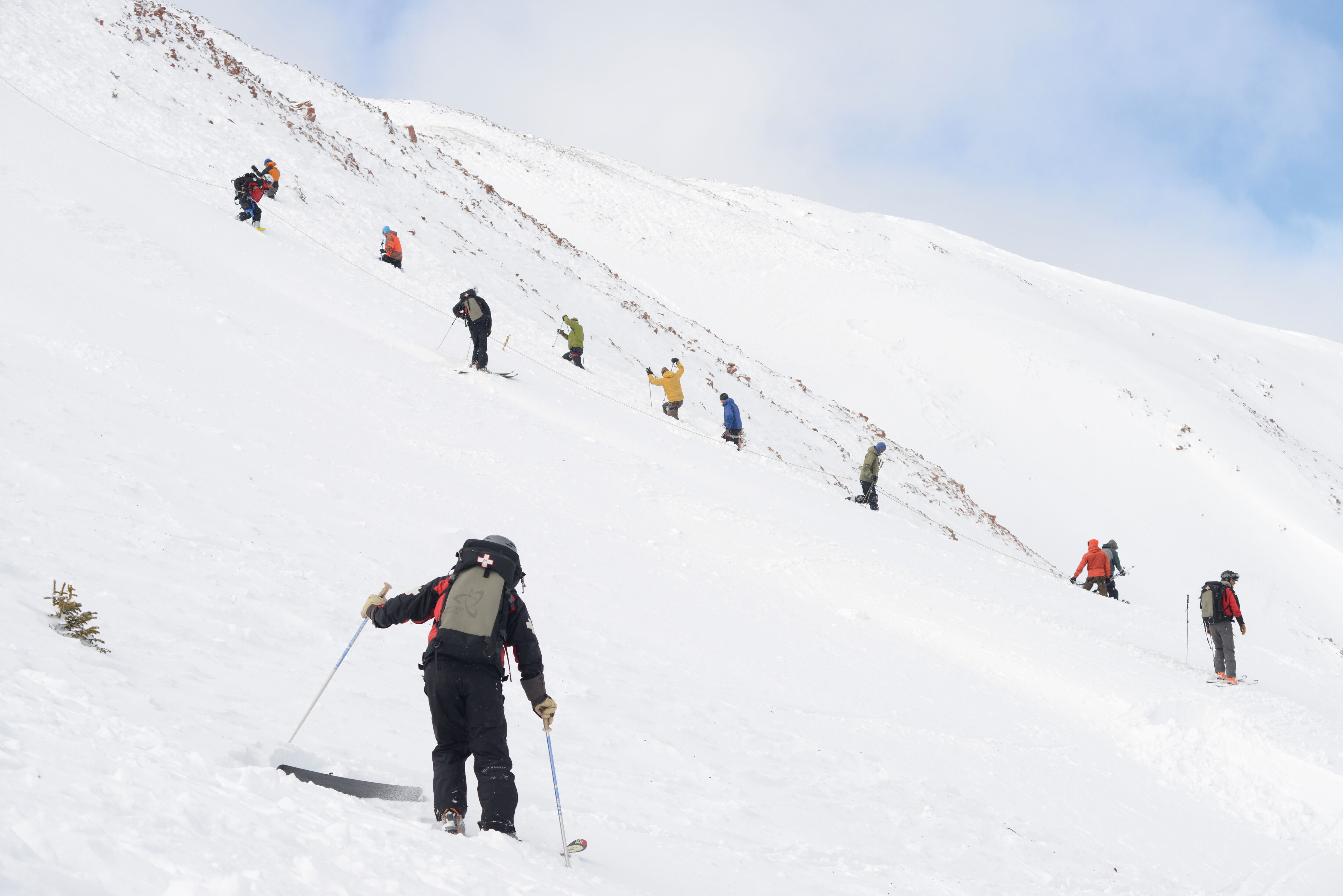
ASPEN MOUNTAIN
Aspen Mountain skis much bigger than its 675 acres would suggest, partly because the area contains all sorts of lines to explore and connect outside of the demarcated runs. Additionally, keep an eye out for trails such as the ones described here.
Anaconda, Black Mamba, and Cobra
expert only
Together, this trio of plummeting runs makes up the Snake Pit and, appropriately, it’s skier beware. Before venturing into this area (accessed by staying high and to the left on Kristi), know that you have the chops to tackle abrupt drop-offs, hop turns in rocky terrain, and variable snow conditions. If you do, you’ll enjoy some of Aspen Mountain’s most challenging signed lines as they slither down the hill.
Backstory: The reason these trails are not on the map, says Aspen Mountain Ski Patrol Supervisor Brad Benson, is because they may open late and close early—both for the season and daily—based on conditions. Not listing them removes expectations that they’ll always be skiable. The area used to be called Hidden Treasure, with runs simply labeled A, B, and C. In the past decade, the letters morphed into full names, with signs.
Uncle Wiggley’s Tree Farm
intermediate to expert
Toward the lower third of Copper Bowl, traverse right to enter a widely spaced aspen grove and look for a handmade sign posted on one of the trees. Enjoy a series of slalom-radius turns down to the intersection of Copper and Spar Gulch.
Backstory: This pitch is named after Howie Mayer, who patrolled on Aspen for close to 50 years. He was one of the first people to regularly ski the area that now bears his nickname, long before the Silver Queen gondola was built alongside it. “He loved making tight, little squiggly turns,” says Benson.
Henry’s
expert to intermediate
This one is on the map—but as the 1A Lift Line (so look for Henry’s instead). The run’s upper half travels down a usually well-moguled, often powdery, pitch in full sight of everyone riding this slow double chair, so be prepared to show off your best form, or suffer catcalls from above if you don’t. The bottom half eases up into the wide-open blue runs beneath the Shadow Mountain lift (a.k.a. 1A).
Backstory: Henry Filip was a hardcore skier who loved Aspen Mountain and liked to ski moguls very fast under the lift. “Even when his shoulder was blown out one winter, he skied in a sling and didn’t use any poles,” recalls Benson. Filip died in a kayaking accident on the Crystal River in 1997. There’s also a run at Aspen Highlands named after him: Filip’s Leap (on the map) in Highland Bowl.
Zoot Chute
expert only
Located between S1 and Short Snort, this tricky little chute down a rock face is only occasionally skiable. It melts out fairly early in the spring, thanks to sun exposure, and for the rest of the season, the snow can be funky. If you just want to see it, enter at the top of S1 and work your way down the left side; you can bypass the chute and come out on Short Snort.
Backstory: “My favorite,” says Benson. But, of course. Benson himself posted the sign this past spring in memory of his former patrol dog, Zoot. An Airedale, Zoot was well known among Aspen skiers for hanging out outside the patrol shack near the Sundeck. “He loved avalanche bombs, and we have a bomb tram out there [by the chute] to rattle snow off those cliffs,” Benson explains. The 34-year patrol veteran now works with Zaugg, a 4-year-old Airedale.
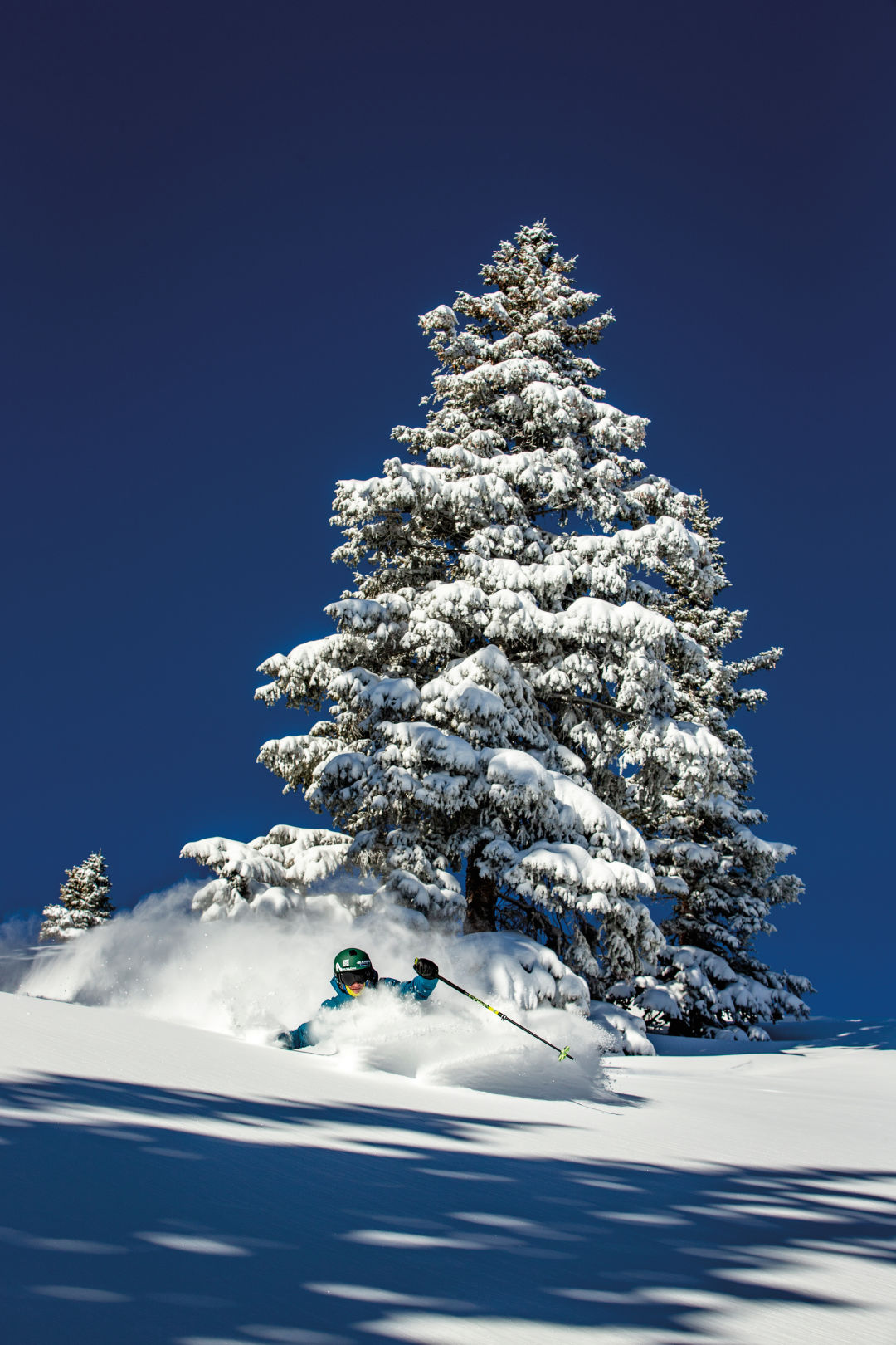
Image: Matt Power
ASPEN HIGHLANDS
More than any of the other mountains, Aspen Highlands has the mother lode of off-the-map trails. With 144 runs already listed, “you just can’t stick that many more on a map,” points out longtime former ski patrol head Mac Smith, who is beginning his 50th year at the mountain. The ski area’s many nooks and crannies hold ample rewards for the intrepid explorer. Here’s just a small sampling of what you may find.
Hot Spot
EXPERT ONLY
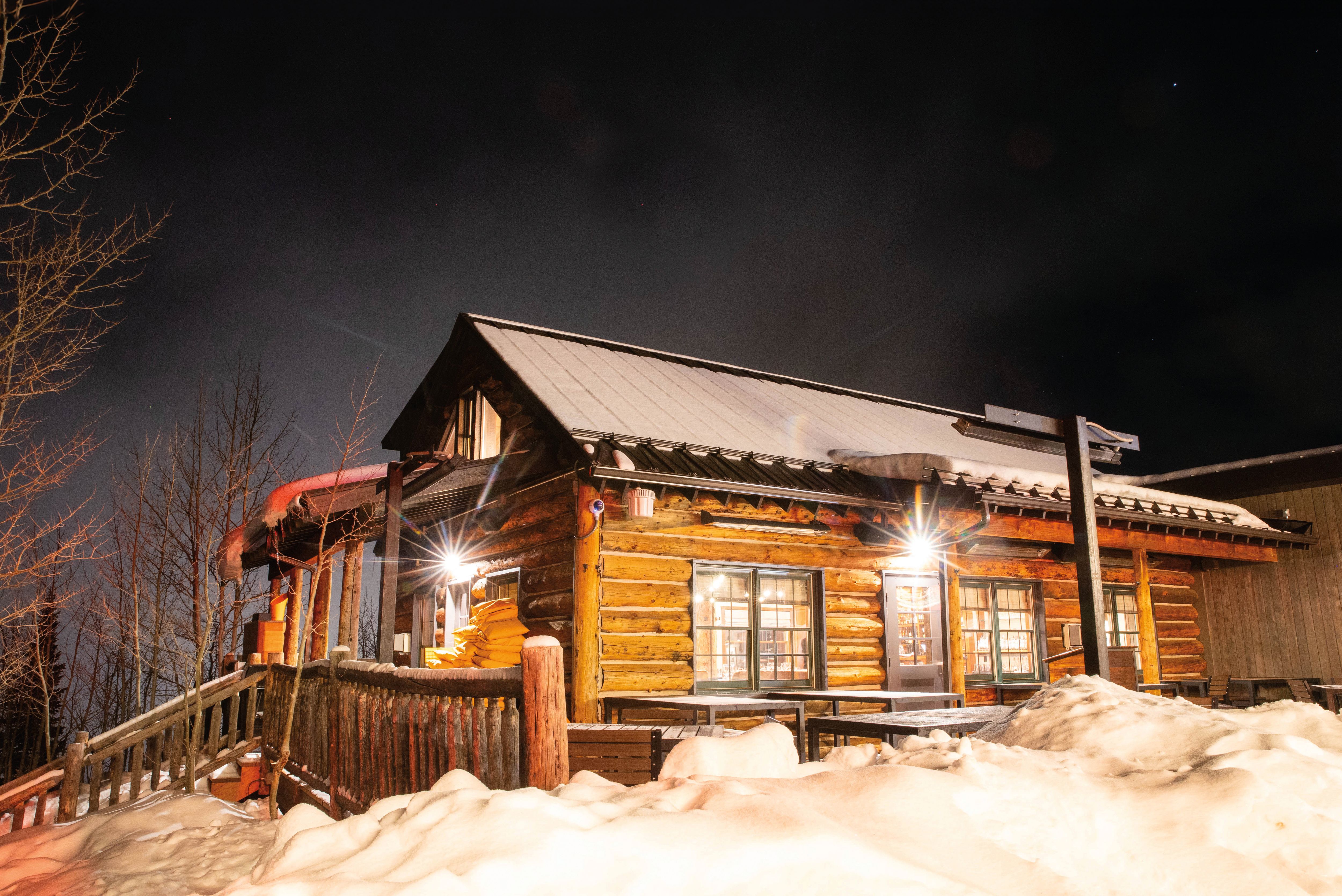
Next to Pyramid Park (easily reached from the Cloud Nine chair), Hot Spot is a legit run that leads skiers down a precipitous face often made more challenging by large moguls. From the bottom, the catwalk leads back to the lift or the Merry-Go-Round mid-mountain restaurant.
Backstory: Orange bamboo poles mark off the Hot Spot itself (a.k.a. the bear cave), a large hole near the end of the run caused by underground thermal activity.
Shred It
intermediate to expert
Ski the T-Lazy-7 catwalk from mid-mountain; on the left, just past Suzi Q, look for this open, short shot, a fun alternative if you’re headed to the base of the mountain. Take the run to another catwalk, hook a left, and wind up under the Exhibition chair. Or if the snow is deep, and your technical skills are strong, continue from Shred It to Whip It, on the other side of the catwalk. The latter requires a lot of coverage to make it good, though; otherwise, you’ll be hopping bushes and rocks.
Backstory: Like many of Highlands’ hidden trails, this one was opened largely so the snow could be compacted by skiers going down it, says Smith, which helps mitigate the avalanche risk above other runs. Years ago, the now-retired Nugget lift went up this slope. Snowboarders who frequented this area in the mid-1990s inspired the name Shred It, says Smith.
GLE
Expert Only
It stands for Greatest Line Ever, and for fans of this perfectly steep, gladed run—where the slope angle allows you to gain that moment of free fall between turns—it often is. The trees here often hold powder for days. To reach it, head to the Steeplechase area and ski the upper section of Garmisch straight down. Just before hitting the traverse, stay right and look for the GLE sign on the other side of the catwalk. The entry can sometimes be sketchy, with a small mandatory drop over a few logs. Stay left toward the bottom of the run, and you’ll come out onto the lower section of Garmisch.
Backstory: Before the opening of the Deep Temerity lift in 2005, this area was out of bounds, bordered by the catwalk that led skiers out of Highland Bowl and across the then-bottom of the Steeplechase runs. Patrollers, however, ventured into GLE to familiarize themselves with the terrain, both to facilitate the rescues of skiers who went past the boundary rope and for the planned expansion into this area.
Fran’s Love
EXPERT ONLY
On the lower half of Soddbuster, look for this trail on the right, which narrows into a gulley lined with aspen and conifers for about 350 vertical feet. The run often has moguls that are spaced out just enough to allow you to swoop down the lines among them.
Backstory: Fran Manello was a diminutive Highlands ski patroller years ago who, unaccountably, skied on very long (215 cm) skis. “If he broke five feet, he’d be lucky,” says Smith. One day when Manello was skiing the then-out-of-bounds terrain here, he do-si-doed among the aspen trees in order to get those long skis around. As Smith explains it, “He’d grab a tree with one arm, make a turn, then grab the next one, and so on.” The unconventional technique lives on with this trail name.
Nark’s Nook
EXPERT ONLY
You might notice the sign if you look down to the left just before unloading from the Cloud Nine lift; it designates a small opening in thick trees. Eight or nine tight turns later, you’ll ski out onto Alps and feel like you just exited another world.
Backstory: The nook’s namesake, Janice Nark, was a ski instructor with a “big personality,” says Smith. She taught at Highlands from the mid-1960s through the ’80s, when Whip Jones owned and ran the resort. “Whip didn’t care if you knew how to teach somebody as long as the guest was having fun,” Smith notes. “It was all about the entertainment value.” Nark made sure her students had the required amount of fun while also shaping them into better skiers.
Kali
EXPERT ONLY
After about 30 medium-sized turns from the top of Meadows, look for an opening in the trees and the trail sign on the right. Traverse directly into the trees, ski down a short open slope, and head down the fall line through aspens and fir trees to traverse back out to the Loge lift.
Backstory: See if you can spot the unusually shaped lodgepole pine on the right, near the top of the run. Its multitude of branches, or “arms,” evoke the Indian goddess for whom the trail is named.
Image: Matt Power
BUTTERMILK
Buttermilk doesn’t have as many unsigned trails as its siblings, but if you include the 10 or so named and signed kids’ trails, the ante gets upped considerably. These single-file routes usually wind through the trees and sometimes have fun features like a ski-through tunnel or themed trailside décor. And why not count them? They’re not listed on the main trail map, after all; you’d need to pick up the Kids’ Mountain Guide map at the ticket office to see their locations. So gather up your young ones, or channel your inner child for the day, and start exploring. Also, keep an eye out for these signed trails, which don’t appear on either map.
Ro’s Romp
INTERMEDIATE TO EXPERT
Cut into Timber Doodle Glade from Klaus’ Way on the Tiehack side of the mountain, then look for the handmade sign that marks this trail. Make quick turns down the relatively narrow path—it follows the old line of the former Number 5 lift—for a few hundred vertical feet. You’ll come out near the bottom of Tiehack Trail.
Backstory: The trail honors Roine St. Andre, Aspen’s first female ski patroller (also known as Ro), who worked at Buttermilk for 29 years, including three years as patrol director. She died of cancer in November 2011. The sign was created by longtime patroller John Beezer.
Robin’s Hood
INTERMEDIATE TO EXPERT
Stay far right on the Tiehack Trail to reach this short-but-sweet route down another section of the old Number 5 lift line that dumps you out near the top of Eagle Hill.
Backstory: The Hood is named for Robin Perry, a former ski patrol director at Buttermilk who retired in 2017 after 25 years at the mountain (preceded by 25 at Aspen Mountain). Perry’s Prowl on Aspen Mountain is named after Robin’s dad, Bob.
Pepper’s Plunge
INTERMEDIATE
On the upper part of Main Buttermilk, spot this sign off Homestead Road after crossing the Ridge Trail. From there, a short, fun little shot drops through the trees to Lover’s Lane. Be prepared for the transition from steep to flat terrain as you exit onto the cat track.
Backstory: The plunge pays tribute to Pepper Gomes, who taught skiing for almost 50 years at Aspen Highlands and Buttermilk. He passed away in 2017 after battling cancer.

Image: Matt Power
SNOWMASS
Spanning more than 3,300 acres, Snowmass provides a seemingly endless number of options for downhill thrills on the mountain. Even skiers who have explored these slopes for years can still discover new lines within the vast, open terrain of the Cirque or Hanging Valley. And then there are these lesser-known trails to keep an eye out for.
Hedgehog
EXPERT ONLY
From the top of the Sam’s Knob chair, scoot left at a distinct opening in the trees, just past Sunnyside. Look for the trail sign about halfway down the narrow run. Ski two short pitches, then traverse left to hit the bottom of Sunnyside. The moguls can get to be proverbially Volkswagen-sized if it hasn’t snowed for several days, but this route offers an alternate way down to the Big Burn chair and avoids the skier traffic on Max Park.
Backstory: Hedgehog developed in a spot where Snowmass’s trail crew had to cut trees and brush to bury a utility line about 20 years ago. Every summer, the crew would clear out a little more terrain until the current route was formed. As for the name, “we were poking fun [literally],” says trail crew boss Jeff High, who’s also a Snowmass ski patrol supervisor in winter. “We thought the run would have been harder to ski when we cut it, but it’s short and easy for a black diamond.” Think of how a hedgehog’s prickly quills belie the soft body underneath, and you’ll get the idea.
Can o’ Corn and Porcupine Chute
INTERMEDIATE TO EXPERT
At Tower 15, under the Sheer Bliss lift, look for the Can o’ Corn sign, which refers to the next pitch of trail. Then spot the sign for Porcupine Chute as the trail continues under the lift on a double-fall line. If you are comfortable on black trails, after the first several turns, head left into Garrett Gulch via Free Fall Glades if not, continue on blue terrain to the bottom of Sheer Bliss.
Backstory: When the Sheer Bliss chair was realigned and upgraded, the trail crew was working with a wood chipper between West Face and Free Fall runs, where Can o’ Corn and Porcupine Chute now exist. Every time a challenge arose, relates High, one crew member would say, “It’s a can of corn,” (i.e., it’s not a big deal, we can get it done). That led to an actual can of corn being fed through the chipper one day, and a run name that lives on. As for Porcupine Chute, it was inspired by the dead porcupine another crew member found as he removed a fallen tree. And … yes, the animal carcass was fed through the chipper, too.
Art’s Ulcer
INTERMEDIATE TO EXPERT
Stay skiers’ right on the cat track at the top of Coffee Pot (reached from the Alpine Springs lift), then look for an obvious cut in the trees, and the trail sign. After skiing this ungroomed run, you’ll end up on wide-open terrain that leads you either to Lunkerville (a blue) or Tom’s Trace (a black).
Backstory: When some concrete tower bases for the old Alpine Springs lift needed to be poured in a hard-to-reach place, Snowmass employee Art Bowles came up with what seemed like an ingenious idea: workers would pour the wet concrete into a series of small chutes that led to each tower base, says High. However, the concrete set up partway down and never reached its destination. And that gave Art his ulcer—or, at least, a very big headache.
X, Y, and Z Chutes
EXPERT ONLY
In Hanging Valley, ski Roberto’s to Frog Pond Glades, then stick to the fall line and keep an eye out for these three chutes (each one has an upper and lower section too). Then get ready for a couple of hundred vertical feet of consistently steep tree skiing. You’ll finish up on Glades One, Two, or Three.
Backstory: Long-time snow safety director John Brennan cut these runs some 20 years ago, and High remembers the alphabet names coming from ski patroller Wayne Hyrup. They help patrollers locate skiers who require assistance in this area of the Hanging Valley’s large swath of terrain.
The Paper Trail Map: An Endangered Species
Over the past few years, ski areas have started to cut back on how many trail maps they print and distribute. The reasons range from reducing the environmental impact and saving money to driving more guests to use a resort’s smartphone app, with digital maps and other info (not to mention the ability to track statistics about each user).
Aspen is no exception to the trend. Last winter the Aspen Skiing Company printed 30,000 trail maps; in the past, as many as 300,000 were produced. SkiCo’s sustainability initiative has driven the change. Additionally, the maps are now printed on a longer-lasting, water-resistant paper that’s created with mineral powder. Skiers can also find large trail maps affixed to some lift’s safety bars on each mountain.
So if you’re a fan of the old-school, pocket-size trail map that you can unfold on the lift or at lunch to plot your ski day, better collect one now. And leave it in the pocket of your ski jacket for future trips, or store it in a safe, dry place for eventual sale on eBay.


Aspen Snapshot
Returning to Barbie’s Dream House

Fun and Games
Aspenites Who’ve Made Their Mark at Winter Olympics

Local Love
Boogie by the Book


At Altitude
An Ecological Haven Gets a $9 Million Makeover
tweet this
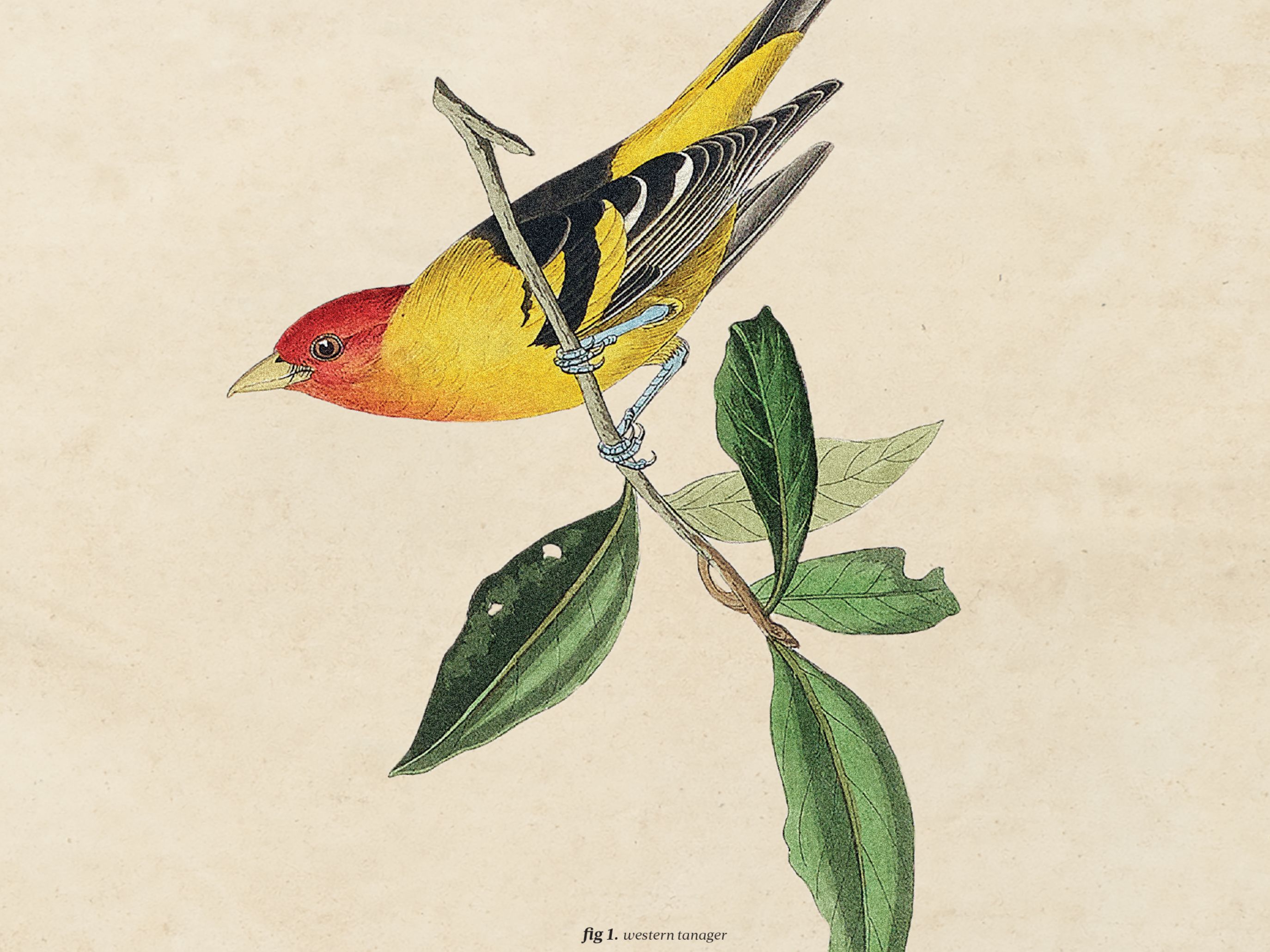
A Birding Big Year in a Small Valley

Your Perfect Day
Where to Golf in the Roaring Fork Valley
Fun and Games
Aspenites Who’ve Made Their Mark at Winter Olympics

At Altitude
Bootpackers Share Favorite Highland Bowl Lines

Thrill List
The Ultimate Guide to Aspen Summer Adventures

Bottle Rocket
Colorado as a Hot Wine Destination?


Eat & Drink
Notable Restaurant Newcomers: Winter 2025-26

Restaurant Listings
Aspen Dining Guide

Feature
Dine Super Local in Aspen


Arts & Events
What to See: William H. Macy’s Variety Show at TACAW
At Altitude
An Ecological Haven Gets a $9 Million Makeover

Arts & Events
Envisioning a Bigger Space for Carbondale Clay Center
Arts & Events
Aspen’s Raizado Festival Returns for a Fourth Year
Mark Your Calendar
The Best of the Aspen Summer Scene

style roundup
Saddle Up Like an Aspen Cowgirl

Objects of Desire
20/20 Vision


Feature
Shop Super Local in Aspen

Fashion
Objects of Desire: Max Factor

Objects of Desire
Wild Style


Shelter
Reimagining a Home as Sculpture


rescue remedy
A Skin Care Must: Antedotum's New Face Oil

Bust a move
Aspen Fitness Three Ways

Retreat Yourself
Carbondale Wellness Sanctuary Is the Ultimate Winter Retreat

High Life
A Guide to Aspen's Dispensaries

Aspen Electric
A Guide to e-Biking in the Roaring Fork Valley

Etiquette Tips
E-Biking in the Roaring Fork Valley

A Night to Inspire
Ascendigo Blue Aspen 2020

People + Places
Pictures from the Winter Season’s Hottest Social Events

People + Places
Winter Fun Recap 2023-2024 Edition

People & Places
ASPENX Beach Club with Gray Malin

People & Places