Hike of the Week: Conundrum Creek Trail
If you time your visit right–think mid-week and during the fall–you may have Conundrum Hot Springs all to yourself.
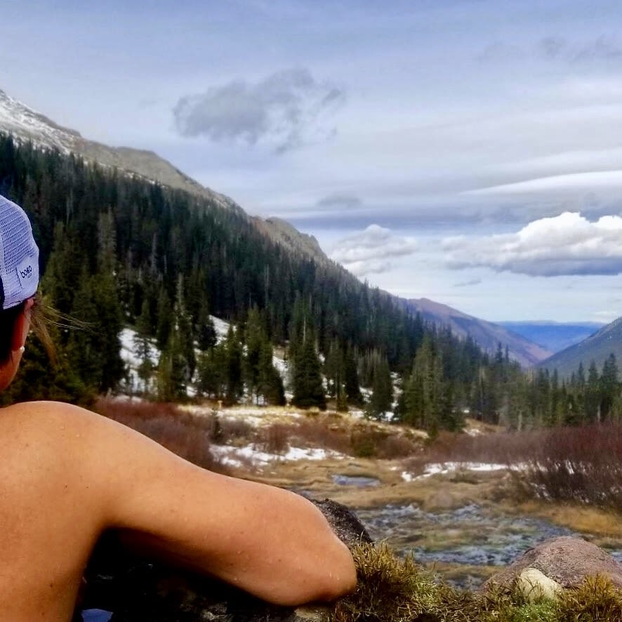
Image: Lauren Steele
Conundrum Creek Trail
Rating: Moderate to difficult
Distance: 17 miles round trip to the hot springs
Elevation gain: 2,500 feet
Estimated hiking time: 8 to 10 hours
Dogs: Must be leashed. Note that they are not allowed at the hot springs themselves or beyond Silver Dollar Pond (which is on the route up to Triangle Pass).
Trailhead: Head downvalley from Aspen on Highway 82 to the roundabout on the edge of town and go three-quarters of the way around it to exit on Castle Creek Road. Drive 5 miles to the turnoff for Conundrum Road on the right. Follow Conundrum Road for 1.1 miles to the small parking lot at its end—and arrive early to get a spot.
Route: While summer trips to Conundrum Hot Springs are incredibly popular (so much so that as of April 2018 a permit is required for overnight stays), early fall is an ideal time to make a day of it, with easier creek crossings, less traffic, and the possibility of having the springs to yourself. You can still camp at one of the 20 sites this time of year (bear-proof containers and camping permits are required year-round), but the journey also makes for a satisfying day trip as long as you are well prepared, both physically and with the right gear.
Located in the Maroon Bells–Snowmass Wilderness (it's one valley over from the Maroon Bells), this hike features beautiful scenery, good footing, and no exposure—but because of the length and the altitude, it isn't easy. The trail begins at 8,700 feet and rises up to 11,200 feet at the hot springs; the route parallels Conundrum Creek and requires three creek crossings along the way. It's mostly uphill on the way out and mostly downhill on the way back, although the grade is manageable (even runnable, if you desire) in both directions.
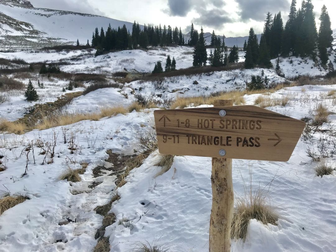
Just before you get to the hot springs, you’ll see signs for camp sites; the trail itself continues for 2 more miles to Triangle Pass.
Image: Allison Pattillo
You'll make your way through open meadows and stands of aspen trees, along ponds, through pine forests, and over a scree field on the easy-to-follow trail. Wear sturdy shoes like light hikers or burly trail runners, bring hiking poles if you like using them, and consider wearing a footwear traction device if the trail is covered in packed snow. You'll enjoy views of Mount Hayden and of Cathedral, Conundrum, and Castle peaks along the way. You'll hit the creek crossings near the 2.75, 6, and 6.5 mile markers. At mile 8, you'll see the remains of an old cabin; at that point, you have just 0.5 miles to go (including another shallow creek crossing) until you reach the hot springs, which are situated just above tree line. If you've made it this far, enjoy a well-earned soak as your reward; the temperature in the largest pool is approximately 100 degrees Fahrenheit.
Be sure to bring extra layers, a waterproof shell, a small towel and a pair of dry socks if you plan on soaking in the springs, plenty of snacks, and your water treatment system of choice. Waste disposal bags are also recommended and remember to pack out what you pack in. There's no cell reception for most of the hike, so let someone know where you're headed.
Camping permits are available at recreation.gov.
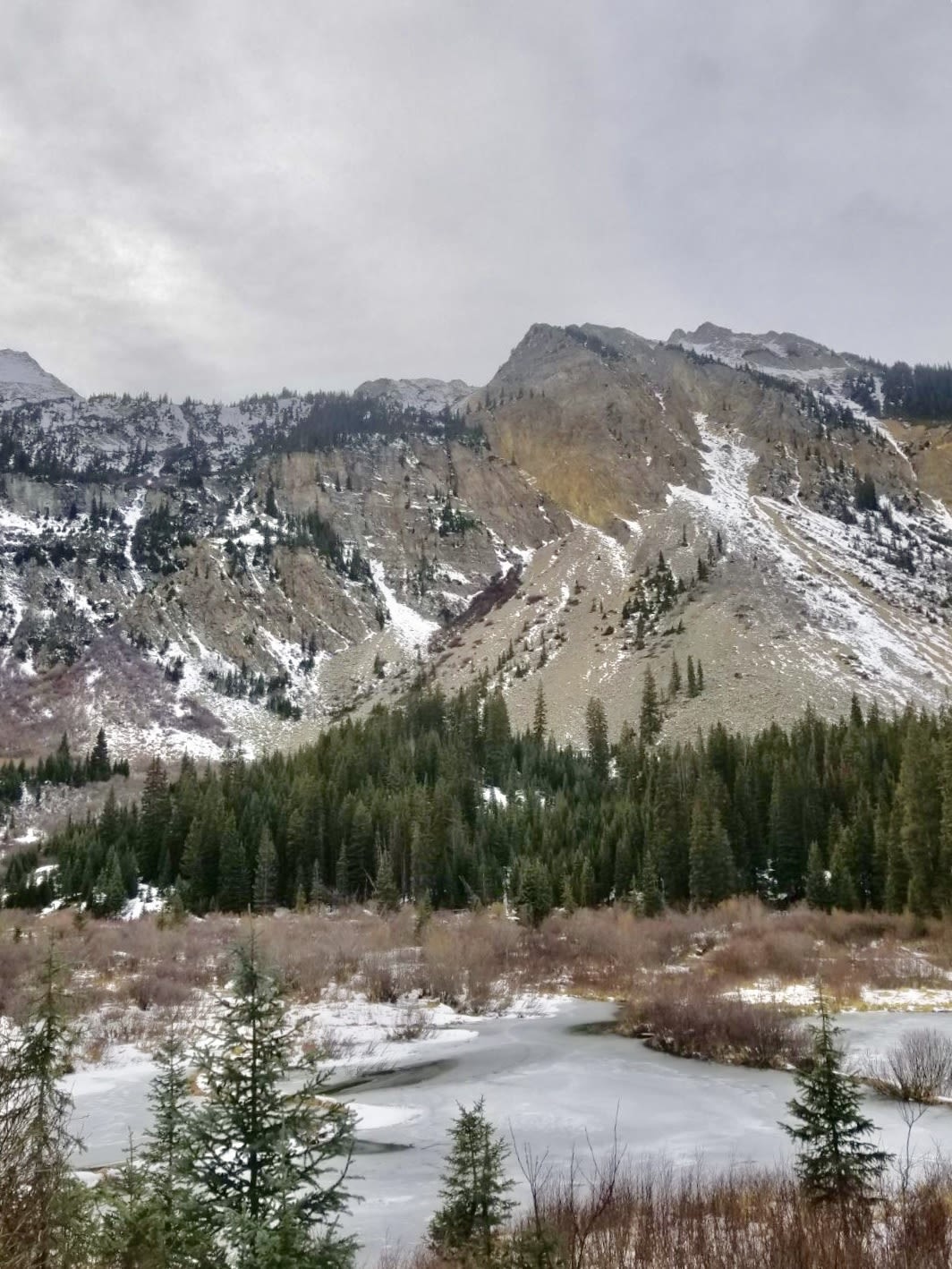
The area around the hot springs is a beautiful, high alpine marsh.
Image: Allison Pattillo