Hike of the Week: Scout Trail
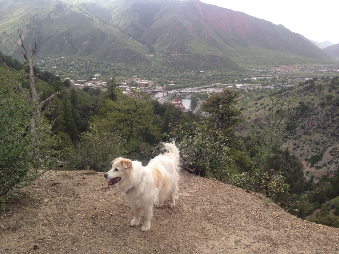
Looking west and down into Glenwood Springs from the trail.
Image: Cindy Hirschfeld
Scout Trail (a.k.a. Boy Scout Trail)
Rating: Moderate except for a steeper section in the last half mile
Distance: 6 miles round-trip all the way to Lookout Mountain Park
Elevation gain: About 2,000 feet
Estimated hiking time: 3 to 4 hours
Dogs: Can be off leash but keep in mind the following: Although the first half mile is within city limits, the trail is not regularly patrolled by animal control. If your dog harasses or injures another hiker or biker, however, you may be cited, among other things, for having a dog off leash. If you’re sharing the trail with a lot of other users, it’s probably best to keep your dog leashed.
Trailhead: From Grand Ave., take 8th St. four blocks east to the end. There’s no trailhead parking lot—just a couple of spaces on the street. Walk down the driveway on the left of 8th St. to the actual trail.
Route: Because this hike is dry and largely unshaded, it’s best as an early morning or evening outing in summer, but nice at any time during spring and fall. Be prepared to encounter some bike traffic, as this is the second, downhill half of an increasingly popular route.
Leaving the trailhead, you’ll face a short, steep climb before the route levels off to a more gradual ascent as it snakes around the hillside. Enjoy the bird’s-eye view into Glenwood Canyon, as well as the one directly across to the giant swing and roller coaster at Glenwood Caverns Adventure Park (listen for the screams!). After about half a mile, you’ll find brief respite in the shade of piñon pines. The trail continues to wind along, tracing the outline of gullies cleaved into the hillside and crossing a couple of scree fields until making another steep, calf-stretching climb up to a plateau full of oak- and sagebrush and, in season, wildflowers. As you hike here, check out the rusted old Chevy truck that’s improbably trailside.
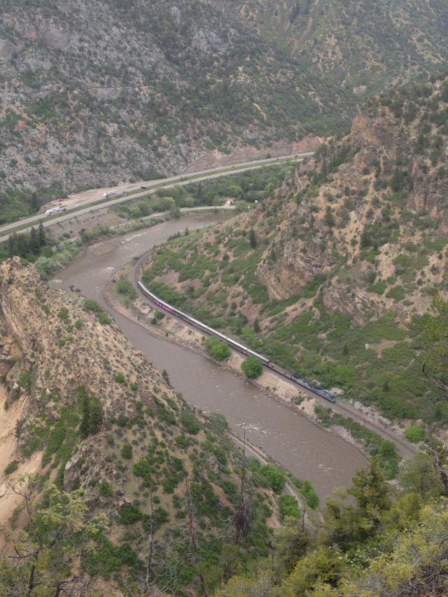
Amtrak's California Zephyr passes a horseshoe bend in the Colorado River.
Image: Cindy Hirschfeld
At the T-intersection at 2.5 miles, go left, then take the next right, about 200 feet ahead (if you stayed straight, you’d be on the Forest Hollow Trail). The final section of trail is less traveled and becomes narrower and rockier as it climbs steadily for another half mile before topping out at an old campground on Lookout Mountain. The only remaining signs of the campground are some picnic tables and a fire grate. Up to the left, you’ll see the end of Lookout Mountain Rd. Savor the views of Mount Sopris and other high peaks of the Elk Range to the south before returning the way you came.