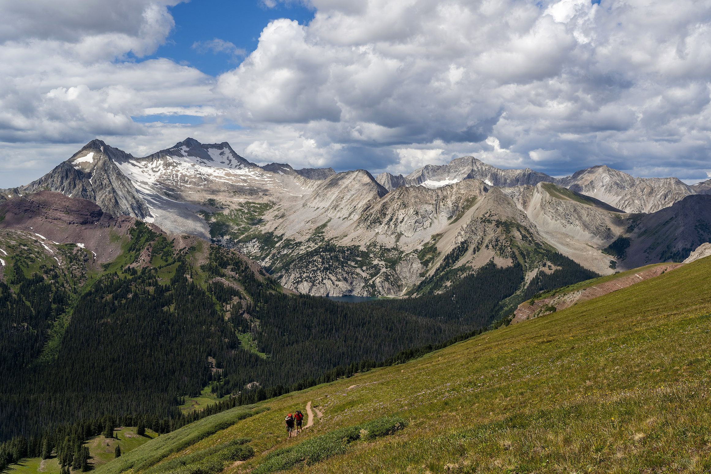
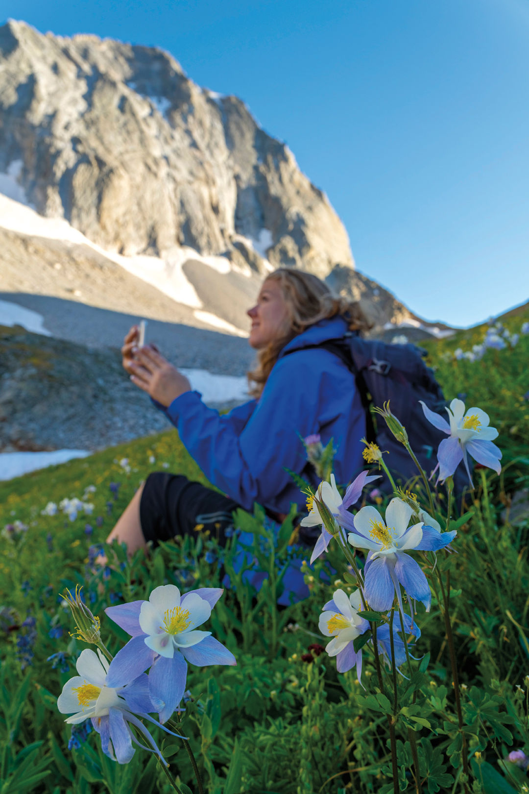
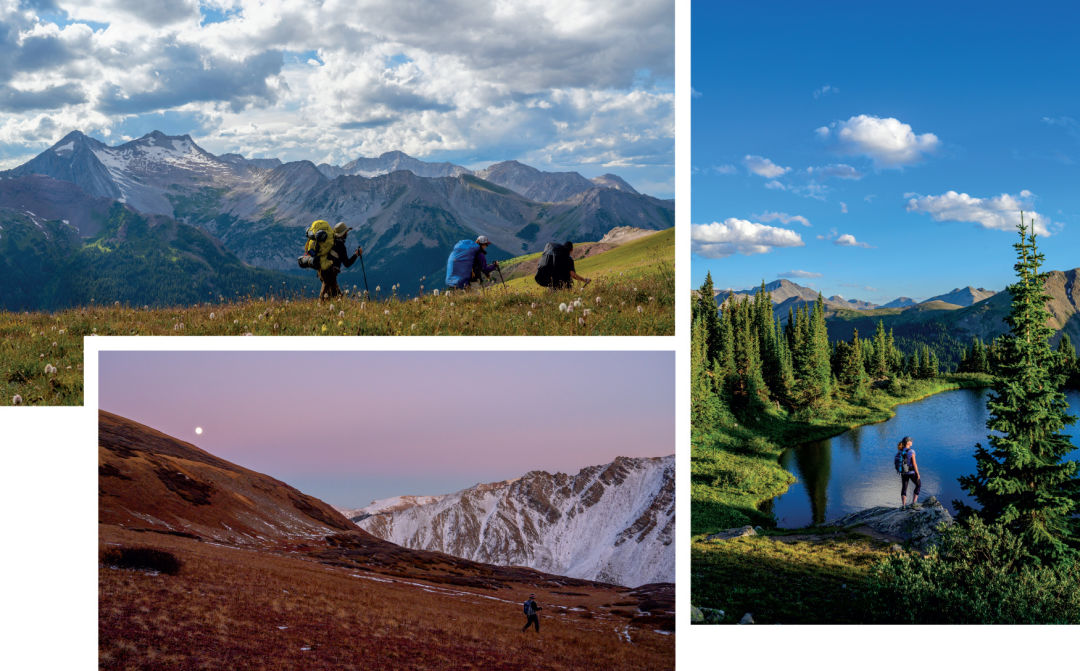
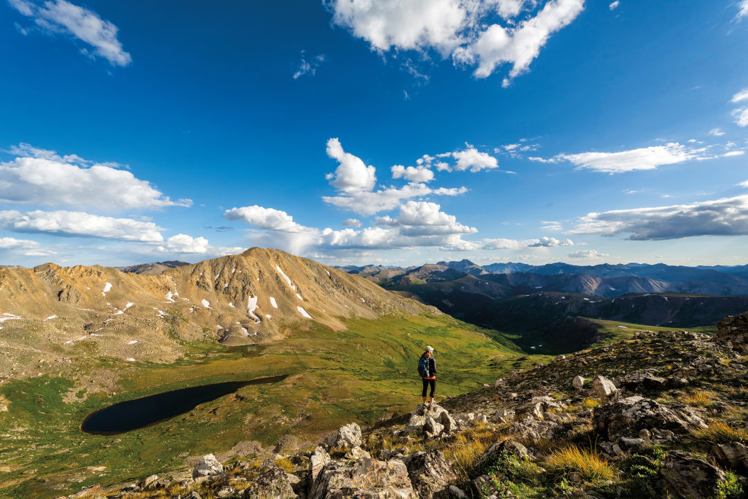
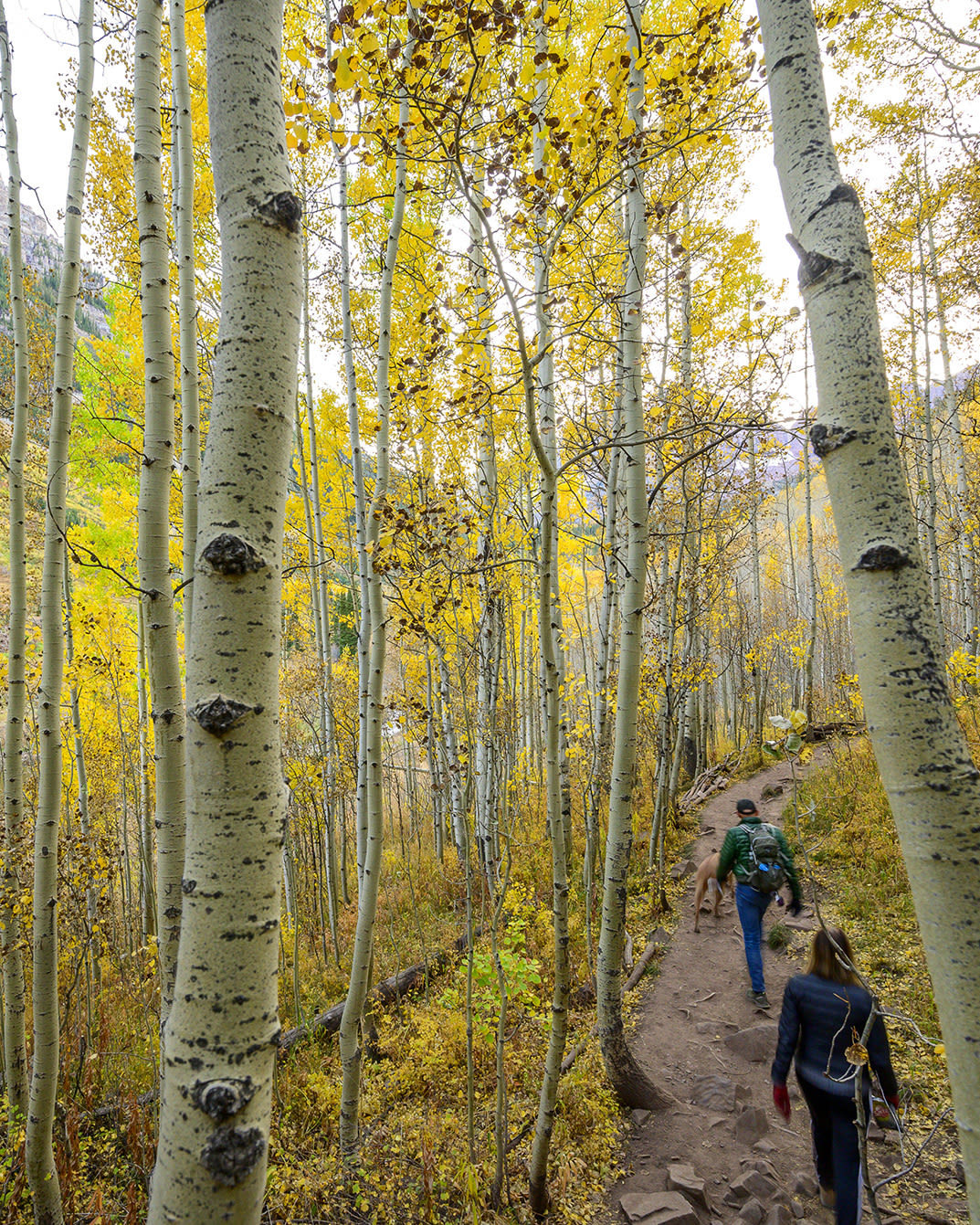
19 Great Hikes in the Roaring Fork Valley
Before You Set Out
Don’t just rely on our write-ups. Pick up a trail map at an outdoors store like the Ute Mountaineer (210 S Galena St) or visit the Forest Service’s Aspen Ranger Station (806 W Hallam St, by the S-curves) for more detailed information. The website pitkinoutside.org has an interactive map of area trails. Also check out aspenrecreation.com and hike.gosnowmass.com for descriptions of trails in Aspen and Snowmass Village, respectively.
Get an early start. Brief afternoon thunderstorms commonly occur in the summer. Leave yourself plenty of time to get down from peaks or high, exposed ridges before a storm hits. And stow a rainshell in your pack.
Acclimate to the altitude. The air is thin up here, and you may find it harder to breathe. Take a couple of shorter hikes closer to town before setting out on a high-alpine adventure. Also allow adequate time to move at higher elevation.
Prep for cooler temps. For a longer hike, pack a fleece or other lightweight but warm layer. The higher you go, the colder it can get, even in the middle of summer.
Carry water and snacks. Stay hydrated with water that you’ve brought. Lakes and streams carry a risk of giardia, a nasty intestinal parasite. Keep from bonking with energy bars, gels, dried fruit, nuts, or whatever your favorite trail snack is.
LOOPS
Don’t want to see the same scenery twice? Set out on one of these routes, which circle back to your starting point with new vistas unfolding the whole way.
Capitol Creek/Capitol Ditch
(a.k.a. Upper Capitol Creek Trail)
At the start of this hike up the spectacular Capitol Creek Valley, you’ll face a decision: Opt for the ditch trail and you’ll parallel a high irrigation waterway, then gently climb through peaceful aspen groves before reaching high grassy meadows. Or choose the trail that descends steeply to the creek, then follows it along the valley floor while offering massive views of Mount Daly and of Capitol Peak’s commanding knife-edge ridge. Either way, the choice is right for this sweet, scenic passage into the Maroon Bells–Snowmass Wilderness. The two trails meet up at the turnoff to popular Capitol Lake (4-plus miles away).
Length: 6.5 miles
Difficulty: Moderate
Trailhead: Drive 14 miles west from Aspen on Highway 82 to Snowmass Creek Road. Turn left. At the T intersection 2 miles in, go right, and follow Capitol Creek Road for about 8 miles to the parking area. The last mile of road requires high clearance and 4WD; you can park a passenger car in a lot 2.25 miles below the trailhead.
Good to know: The parking area fills up early, especially on weekends, as many climbers backpack from there to the lake for an attempt on 14,130-foot Capitol Peak.
Smuggler Mountain/Hunter Creek
An easily accessible jaunt from the edge of town, this loop is an Aspen classic that provides views, meadows, a rushing creek, and the feeling of being much farther away from civilization than you are. Hike up the well-traveled Smuggler Mountain Jeep road to the observation platform, take in the panorama of Aspen, then follow the Hunter Creek Cutoff Trail down to the valley floor. A left on the Hunter Valley Trail eventually brings you to Benedict Bridge. Head down the boulder-strewn lower Hunter Creek Trail, immediately left after the bridge, and you’ll be treated to sweeping views of all four ski mountains and beyond. Exit by the Hunter Creek condos, a short walk from the base of Smuggler.
Length: 4.8 miles
Difficulty: Moderate
Trailhead: Access Smuggler from Park Circle; there are two small parking areas.
Good to know: You don’t need a car. Ride the Hunter Creek bus (rfta.com) to the Centennial stop near Smuggler, then pick it up by the condos for your return. Or ride a WE-cycle bike (we-cycle.org) and dock it near the base of Smuggler.
Avalanche Pass/Silver Pass (overnight)
With such plentiful access to the Maroon Bells–Snowmass Wilderness near Aspen, it’s easy to forget there are other entry points. North Lost Trail, east of Marble, is one such place. For intrepid backpackers comfortable with route finding, a stunning loop starts here, heads over Avalanche Pass, descends to the West Fork of Avalanche Creek, and finishes up on the Avalanche Silver Creek Trail, with a final push over Silver Pass and down a wildflower-carpeted meadow. Trail markings are few, but the sky-scraping views of Capitol Peak are plentiful.
Length: About 17 miles
Difficulty: Strenuous
Trailhead: From Carbondale, drive Highway 133 for 25 miles to the left turnoff for County Road 3 to Marble. Drive through town to Beaver Lake. One mile past the lake, stay left on Forest Road 315 toward Lead King Basin (high clearance required); look for the trailhead shortly after on the left by the first notable stream crossing.
Good to know: Once back in Marble, treat yourself to a well-deserved meal at Slow Groovin’ BBQ.
PASSES
The ascent to a mountain pass is a worthy goal that rewards you with a view into another valley.
Buckskin
From the start of the route at Maroon Lake to the top of the pass at 12,462 feet, you’ll be so enamored of the stunning surroundings that you may forget about the effort required to get there (almost 3,000 feet of elevation gain). After the turnoff near Crater Lake, the trail passes through quaking aspen stands and subalpine fir as it ascends Minnehaha Gulch, then breaks out into tundra dotted with wildflowers before steeply switchbacking to the top. En route, enjoy the vantage point into the glacially carved Maroon Creek Valley, and watch for mountain goats clattering on the red ribs of North Maroon Peak. From the pass, you’ll have a vista of Snowmass Lake, several fourteeners, and the West Elks beyond.
Length: 9.6 miles round-trip
Difficulty: Strenuous
Trailhead: See East Maroon entry; go all the way to Maroon Lake.
Good to know: Buckskin is part of the renowned Four Pass Loop, which most hikers complete in three to four days, though some well-conditioned trail runners tackle it in one (long) day.
East Maroon
(overnight in Crested Butte)
With its gentle grade and beckoning views, the route over East Maroon Pass is five miles longer but much less trafficked than the standard West Maroon Pass route to Crested Butte. The East Maroon Trail follows an old roadbed through meadows and aspen groves for several miles before emerging in a glacial valley on the lesser-seen side of Pyramid Peak. Once you cross the pass at 11,835 feet, you’ll descend to Crested Butte on the Copper Creek Trail, passing beautiful Copper Lake and Judd Falls.
Length: 16 miles one way
Difficulty: Moderate to strenuous
Trailhead: Between 8 a.m. and 5 p.m., you must ride the bus up Maroon Creek Road (ask to be let off at the East Maroon Portal), and advance reservations are required this summer. Outside of those times, you’ll need reservations to park your car at the trailhead, 6.5 miles up Maroon Creek Road. Find all info at aspenchamber.org.
Good to know: Reserve space on one of the private shuttles that ferry hikers into Crested Butte, or catch the public Gothic bus (mtnexp.org), which makes four round trips daily to the trailhead.
Electric
At 13,500 feet, this is Colorado’s highest trail pass. The distinction also means it’s especially prone to lightning strikes (hence the name). A challenging add-on to the Cathedral Lake hike, the trail traverses the flower-laden tundra above the lake before crossing onto the talus-strewn shoulder of Leahy Peak. The pass is a barren high point above the Conundrum Creek Valley that offers stunning views of Pyramid Peak, the Maroon Bells, and Snowmass Mountain—well worth the 3,600-foot elevation gain.
Length: 9.2 miles round-trip
Difficulty: Strenuous
Trailhead: Drive Castle Creek Road from the Aspen roundabout for 12.2 miles (you’ll pass the ghost town of Ashcroft) to the trailhead turnoff on the right.
Good to know: Start hiking early in the day to avoid being on the pass during afternoon thunderstorms.
Midway
A slightly shorter and less-frequented alternative to the popular Lost Man Loop, this often-overlooked half-day hike begins at the same trailhead. After switchbacking steadily through dense, sweetly scented spruce forest, the trail gives way to trembling columbine clusters, thick paintbrush, and subalpine fir. Before long, you’ll reach the tundra and get sweeping views of Independence Pass and beyond. Climb gently past some small, marshy ponds, then descend slightly to a low point in the ridgeline at 11,840 feet. From here, gaze down into the Hunter Creek Valley before turning around.
Length: 7.8 miles round-trip
Difficulty: Moderate
Trailhead: Drive 14 miles east from Aspen on Highway 82; park at the Lost Man trailhead on the left.
Good to know: The pass itself isn’t actually the hike’s high point; that comes 3 miles in at 12,120 feet.
CLASSICS
Of all of the hikes around Aspen, these are some of the most popular, and with good reason. Just Be prepared to share the trail with other enthusiasts.
Cathedral Lake
Begin hiking through thick aspen groves before starting to parallel gurgling Pine Creek; detour to overlook the roiling cascades below. Eventually, you’ll ascend eight short but very steep switchbacks before the final push to the lake, which is ringed by an amphitheater of craggy summits, including 13,943-foot Cathedral Peak, named for its fluted, commanding presence. Picnic by the shoreline, fish for cutthroat trout, or carry on to Electric Pass (see Pass hikes).
Length: 5.6 miles round-trip
Difficulty: Moderate to strenuous
Trailhead: See Electric Pass entry
Good to know: Make a lunch reservation at the nearby Pine Creek Cookhouse, one of Aspen’s most beloved restaurants, to refuel on house-smoked trout and the Nepalese dumplings known as momos.
Ute Trail
Why use a Stairmaster when you can climb the Ute? The rocky trail not only ascends 700 feet in less than a mile, it also offers a fine view of Aspen. From the trailhead, follow steep, shaded switchbacks to a rocky outcropping. Pause for a snack before heading down, or continue onward for another hard-won 2,300 vertical feet (and 3.1 miles total from the start) up Gentleman’s Ridge to the Sundeck atop Aspen Mountain.
Length: About 2 miles round-trip
Difficulty: Strenuous
Trailhead: Walk east on Ute Avenue for .4 miles from downtown; look for a small wooden trail sign on the right. Or ride the Cross Town Shuttle bus (note that service is suspended this summer) or a WE-cycle bike, which you can dock at the Gant condos nearby.
Good to know: If you hike to the top of Aspen Mountain, save your knees and take the Silver Queen Gondola down—a free perk daily through September 7, then on weekends through October 4.
Crater Lake
Framed by the glacial U-shape of West Maroon valley, this picturesque lake seems dwarfed by the geometric sides of 14,014-foot North Maroon Peak rising above it. As you hike from Maroon Lake, you’ll pass through quaking aspen groves that give glimpses of the glittering water below and towering 14,018-foot Pyramid Peak across the valley. A few steep spurts lead to a boulder field accented by white aspen trunks, delicate columbines, and a beckoning view of North Maroon. Reward your efforts with a lakeside picnic, or bring camping gear to sleep under the stars in the dispersed spots on the lake’s west end.
Length: 3.6 miles round-trip
Difficulty: Moderate
Trailhead: See East Maroon entry; go all the way to Maroon Lake.
Good to know: Start hiking early not only to avoid crowds, but also to watch the sun light up North Maroon’s red rock.
Lost Man
Though this hike is often referred to as Lost Man Loop, it’s not a true circular hike, as four miles of Highway 82 separate the two trailheads. From the Upper Lost Man trailhead, gradually climb up an alpine meadow alongside babbling Upper Roaring Fork Creek; the multipeaked ridgeline of Geissler Mountain borders on the left while Twining Peak rises to the right. The reward for your climb? The shimmering waters of Independence Lake. Continue to a gentle, rocky saddle at 12,800 feet that gives way to a view of the lush Lost Man Valley below and the crusty Williams Mountains beyond. Descend into the basin and pause on the shores of Lost Man Lake before enjoying a gradual walk into a marshy valley that’s often carpeted with wildflowers. Soon after you pass Lost Man Reservoir, you’ll arrive at the lower trailhead.
Length: 8.8 miles point to point
Difficulty: Moderate
Trailhead: Drive 18.5 miles east from Aspen on Highway 82; park in the area to the left of the big switchback. You can also hike in reverse, starting at the trailhead 14 miles east of Aspen on the left.
Good to know: Drop another car at one of the trailheads to shuttle at the end of the hike, or try your luck at thumbing a ride back to your vehicle.
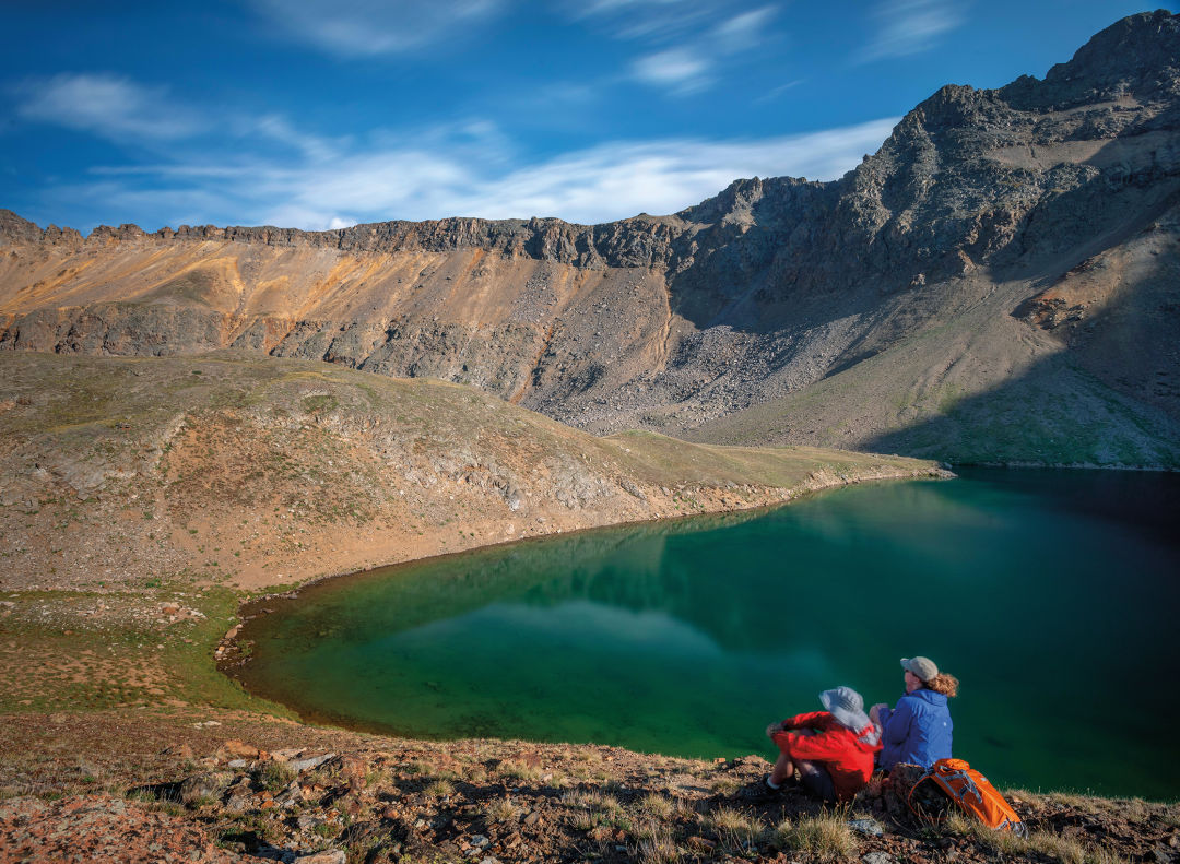
LAKES
Hiking to a high-mountain lake is an unforgettable experience; the water glistens in the sunlight, small waves gently lap the shore, and trout ply the depths. These are some of our favorites.
Lyle/Mormon
The adventure of hiking to this pair of lakes begins with getting there, as you’ll travel far up the Fryingpan Valley, then drive a dirt road along an old railroad grade bordered by a steep drop-off into the valley below. The trail itself ascends gently along Lyle Creek into the Holy Cross Wilderness. Rosy paintbrush and marsh marigold sprout along the way. At Lyle Lake, stop for a snack or cast for trout, then continue on a well-worn trail to looker’s right of the lake. An easy descent takes you to the shoreline of Mormon Lake, a glittering tarn nestled in the tundra.
Length: 3.3 miles round-trip to Lyle; 5.3 miles round-trip to Mormon
Difficulty: Moderate
Trailhead: Drive 33 miles from downtown Basalt up Frying Pan Road until the pavement ends. Bear left and drive along the dirt road 10 miles to a sign for Hagerman Pass; turn left. The trailhead is just ahead on the left.
Good to know: The last several miles of road can be rough but are navigable by most passenger cars.
Williams
The hike initially travels through spruce forest, climbing for about a mile before a turnoff to the right takes you down to a stream. As you climb the last rocky bit of trail to the lake, enjoy the serenade of creek water tumbling past and bird calls enlivening the otherwise quiet forest. Columbines and purple asters sway alongside the trail. Ringed by a red rock cirque, the teal waters of Williams Lake offer an inviting spot to rest or fish— or perhaps even sing.
Length: 4.5 miles round-trip
Difficulty: Moderate
Trailhead: See Capitol Creek/Capitol Ditch entry; continue farther to the Hell Roaring Trailhead.
Good to know: It’s said that John Denver wrote “Rocky Mountain High” while resting on the shores of this small, tucked-away lake, and a journey here makes it obvious why.
Willow (overnight)
To experience the splendor of the Maroon Creek Valley without the crowds, it’s tough to beat an overnight backpack to Willow Lake, a secluded tarn at the head of the Willow Creek Valley. From where the route splits off the Buckskin Pass Trail, at around 12,000 feet, you’ll feel like you’ve entered a hidden red rock kingdom. Listen for the clatter of mountain goat hooves on the steep mountainsides around you. The trail wanders through a high-alpine basin checkered with rosy paintbrush before climbing steeply to Willow Pass. From there you’ll spot your destination: a soft, rolling basin flanked by rocky slopes and dotted with shimmering lakes. The largest of the lakes, tucked in the basin’s southeast corner, is your resting spot for the night.
Length: 12.4 miles round-trip
Difficulty: Strenuous
Trailhead: See East Maroon entry; go all the way to Maroon Lake.
Good to know: For variety, return via the East Snowmass Trail, a sturdy 8.5-mile hike out; you’ll need to set up a car shuttle.
Grizzly
Situated in a high-alpine basin with the toothy summit of 13,988-foot Grizzly Peak towering above, this gem is not to be missed. The trail begins at 10,560 feet and winds through subalpine spruce to a high valley flush with wildflower-studded meadows. The jagged summits and ridges of the Collegiate Peaks Wilderness rise as you ascend to a broad shelf covered with scrubby, gnarled krummholz. One final, long switchback leads you to the rocky lakeshore, where turquoise waters lap.
Length: 7.2 miles round-trip
Difficulty: Moderate
Trailhead: Drive 11 miles east of Aspen to Lincoln Creek Road and turn right. Continue for 6.1 miles to the trailhead on the left just after Grizzly Reservoir.
Good to know: Lincoln Creek Road, though not 4WD, requires a high-clearance vehicle.
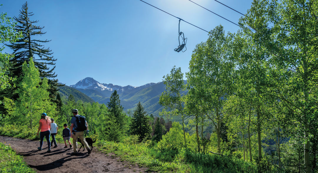
FAMILY-FRIENDLY
Whether because of their short length or accessible level of challenge, these hikes are great options for kids who like to explore.
Little Cloud
This hike gently climbs the lower reaches of Aspen Mountain through a pine forest, giving an overview of downtown. A series of short, moderately steep switchbacks leads to the intersection with Summer Road and a meadow often accented by wildflowers.
Length: 1.2 miles round-trip
Difficulty: Easy to moderate
Trailhead: Walk Durant Avenue west from downtown until it intersects with South Garmisch Street, and pick up the Midland Trail; the Little Cloud Trail will start soon on the left.
Good to know: In 1888, the Colorado Midland Railroad began running along what’s now the Midland Trail, transporting ore from the mines on Aspen Mountain.
Weller Lake
With minimal elevation gain and a lake at the end, this hike has a big payoff. The route threads through subalpine fir and Engelmann spruce before giving way to an aspen grove near the rocky lakeshore. While the trail ends here, the lake, situated below a cirque of craggy peaks, offers ample opportunities for exploration.
Length: 1.2 miles round-trip
Difficulty: Easy
Trailhead: Drive 9 miles east of Aspen on Highway 82. Trailhead parking is on the right (just before Weller Campground).
Good to know: Consider a side trip to the Grottos day-use area, less than a mile away, where a series of short trails leads to waterfalls, ice caves, and cool rock formations.
Ditch Trail
This mellow trail with outstanding views in Snowmass Village begins by traversing the lower slopes of Snowmass ski area, then parallels an old irrigation ditch through shady aspens. The farther you go, the bigger the views of Mount Daly and the Snowmass Creek Valley. Hike out and back as far as you want, or continue to the junction with the East Snowmass Creek Trail.
Length: Up to 3.2 miles round-trip
Difficulty: Easy
Trailhead: Drive Divide Road in Snowmass Village to Pinon Drive on the left; trailhead parking is on the right. Or hike up from the top of Carriage Way near the Snowmass Mall via Sleigh Ride Trail, about .75 miles each way.
Good to know: Those dogs you may hear howling at the trailhead? They belong to Krabloonik, the kennel across the road that offers dog-sled tours in winter.
Savage Lakes
With roughly 1,200 feet of elevation gain, this is a perfect day trip for more intrepid young hikers to a pair of high-alpine lakes. The rocky trail switchbacks, somewhat steeply at first, through dense spruce. Sounds of the creek accent the air as you pass the Holy Cross Wilderness boundary and the trail, now mellower, begins to follow the North Fork of the Fryingpan River. At approximately 1.6 miles, you’ll meet lake number one. Look for cairns on the left that mark the way to the upper lake. From here you can gaze at an amphitheater of 12,000-foot peaks, find a flat rock for picnicking, or fish.
Length: 4 miles round-trip
Difficulty: Moderate
Trailhead: Drive 27 miles from Basalt up Frying Pan Road to Meredith. About 3 miles farther, turn left on Forest Road 501. One mile after Elk Wallow Campground, take the left fork and drive 3.25 miles to the trailhead on the left. Park in the pullout on the right.
Good to know: Stop at the general store in Meredith for snacks pre- or post-hike.


Aspen Snapshot
Returning to Barbie’s Dream House

Fun and Games
Aspenites Who’ve Made Their Mark at Winter Olympics

Local Love
Boogie by the Book


At Altitude
An Ecological Haven Gets a $9 Million Makeover

tweet this
A Birding Big Year in a Small Valley

Your Perfect Day
Where to Golf in the Roaring Fork Valley
Fun and Games
Aspenites Who’ve Made Their Mark at Winter Olympics

At Altitude
Bootpackers Share Favorite Highland Bowl Lines

Thrill List
The Ultimate Guide to Aspen Summer Adventures

Bottle Rocket
Colorado as a Hot Wine Destination?


Eat & Drink
Notable Restaurant Newcomers: Winter 2025-26

Restaurant Listings
Aspen Dining Guide

Feature
Dine Super Local in Aspen


Arts & Events
What to See: William H. Macy’s Variety Show at TACAW
At Altitude
An Ecological Haven Gets a $9 Million Makeover

Arts & Events
Envisioning a Bigger Space for Carbondale Clay Center
Arts & Events
Aspen’s Raizado Festival Returns for a Fourth Year
Mark Your Calendar
The Best of the Aspen Summer Scene

style roundup
Saddle Up Like an Aspen Cowgirl

Objects of Desire
20/20 Vision


Feature
Shop Super Local in Aspen

Fashion
Objects of Desire: Max Factor

Objects of Desire
Wild Style


Shelter
Reimagining a Home as Sculpture


rescue remedy
A Skin Care Must: Antedotum's New Face Oil

Bust a move
Aspen Fitness Three Ways

Retreat Yourself
Carbondale Wellness Sanctuary Is the Ultimate Winter Retreat

High Life
A Guide to Aspen's Dispensaries

Aspen Electric
A Guide to e-Biking in the Roaring Fork Valley

Etiquette Tips
E-Biking in the Roaring Fork Valley

A Night to Inspire
Ascendigo Blue Aspen 2020

People + Places
Pictures from the Winter Season’s Hottest Social Events

People + Places
Winter Fun Recap 2023-2024 Edition

People & Places
ASPENX Beach Club with Gray Malin

People & Places