Hike of the Week: Ute Trail
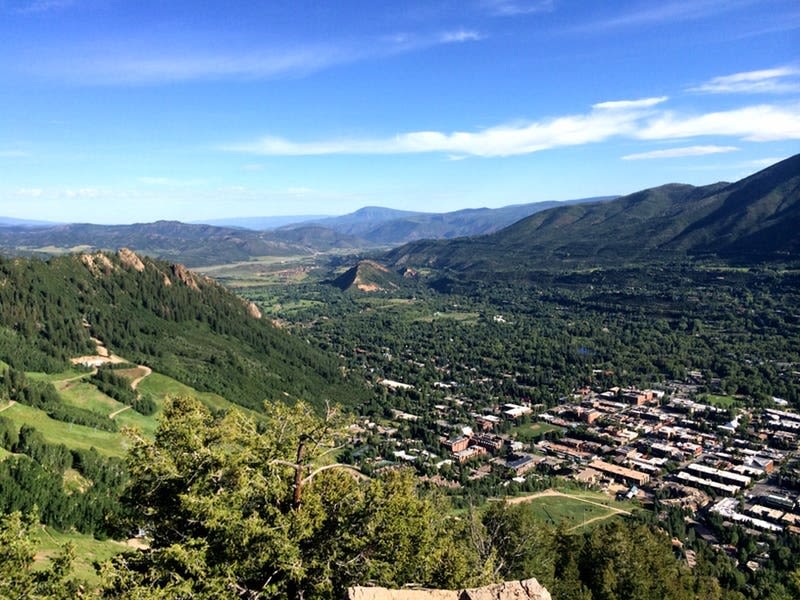
The Ute Trail reward is this bird’s-eye view of town.
Image: Jennifer Broome
Ute Trail
Rating: Difficult
Distance: About 2 miles round-trip
Elevation gain: 700 feet
Estimated hiking time: 1 to 1 ½ hours
Dogs: Must be under voice and sight control
Trailhead: It’s within walking distance of downtown Aspen. Head east on Ute Ave. for about 0.4 mile. Shortly after you come to a house with a multitude of windows, look for the small wooden trail sign on the right (across from a parking pullout for Ute Park). Or ride over on a WE-cycle bike; there’s a nearby docking station at the Gant condominiums.
Route: Because of its proximity to town and its low mileage, the popular Ute Trail is a super-efficient way to exercise—think of it as a natural Stairmaster. This short trail switchbacks steeply up the lower third of Aspen Mountain; thankfully, much of it is in the shade. (If you have knee issues, we recommend bringing a pair of collapsible hiking poles for the descent). The reward is a bird’s-eye view of town from the rock outcroppings at the end. Don’t forget water—you’ll need it while tackling the lung-busting climb. Hike all the way to the top of Aspen Mountain from the top of the Ute if you want a longer outing (3.1 miles from the trailhead to the summit)—you can ride the Silver Queen gondola down for free (daily through Sept. 4, 10 a.m.-4:30 p.m.).
Download the Pitkin Outside app for more information and detailed trail maps: aspenrecreation.com