West Elk Loop Scenic Byway
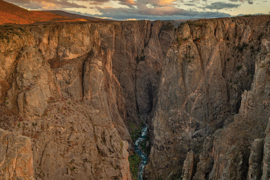
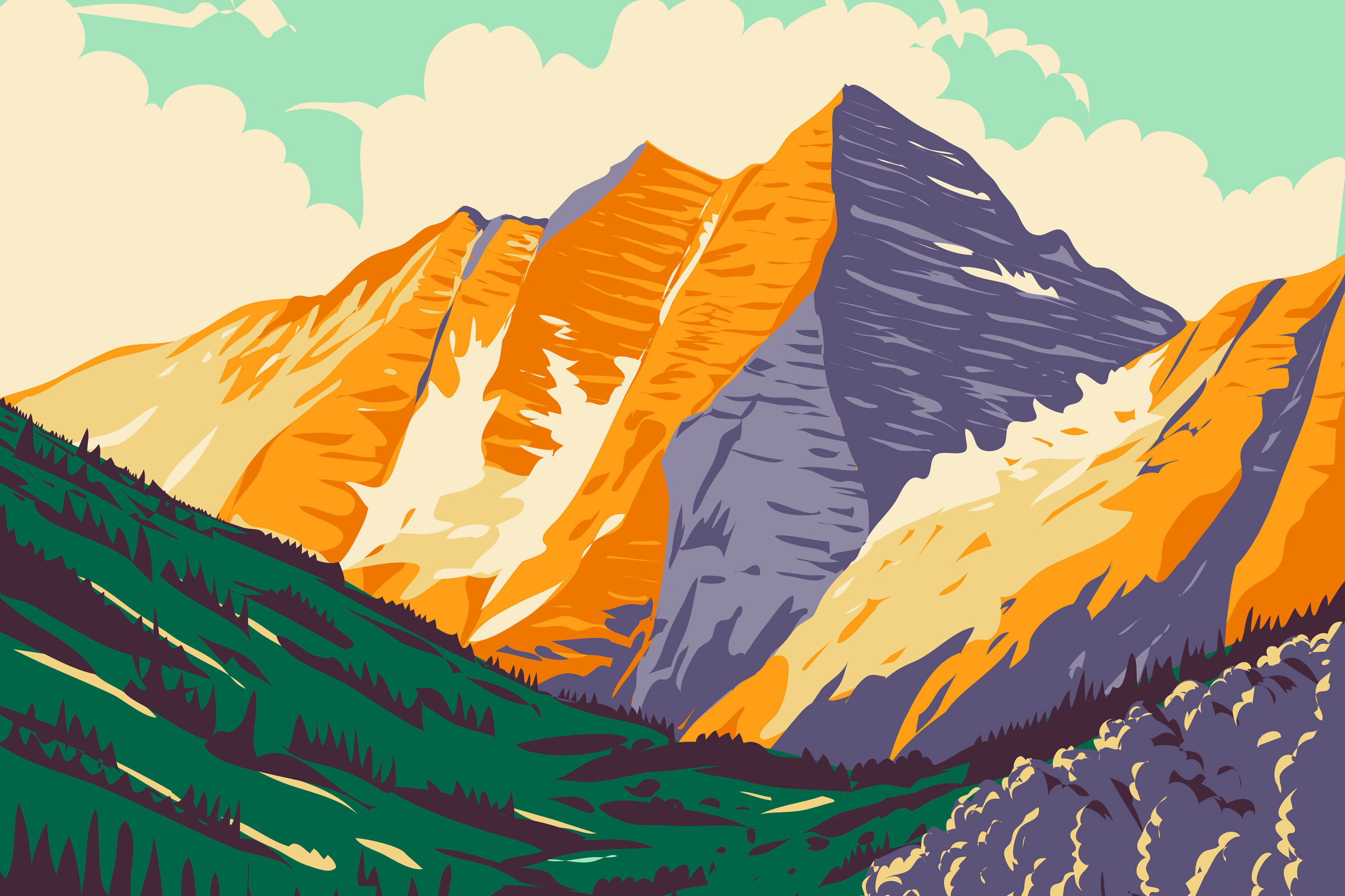
Image above: The Black Canyon of the Gunnison's near-vertical walls
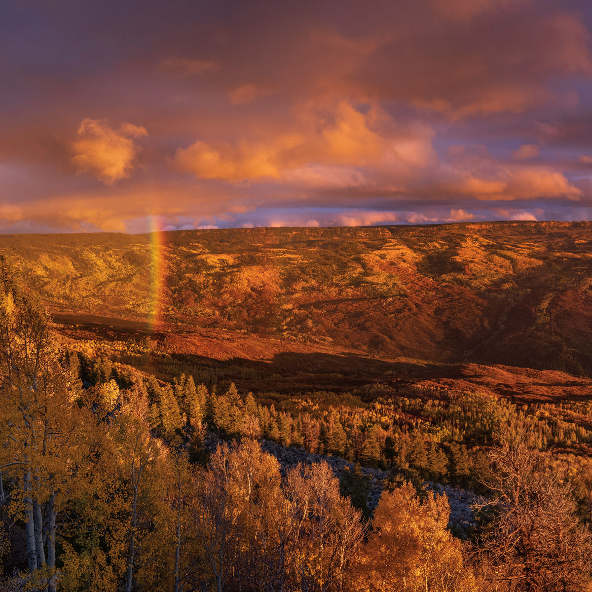
A microcosm of Colorado itself, this drive includes a little bit of everything, other than a large city. You’ll go through Carbondale and Crested Butte, both quintessential mountain towns and designated Colorado Creative Districts in honor of their thriving arts scenes. Redstone, Marble, and Somerset started as small mining communities and have since evolved in radically different ways. Paonia and Hotchkiss produce much of the state’s fruit, while Gunnison and Crawford are in the middle of ranching country. Add in scenic wonders like the mighty Black Canyon of the Gunnison, three National Forest wilderness areas, and Colorado’s largest body of water.
distance: 205 miles, traveling the loop counter-clockwise from Carbondale to Paonia State Park
Day 1
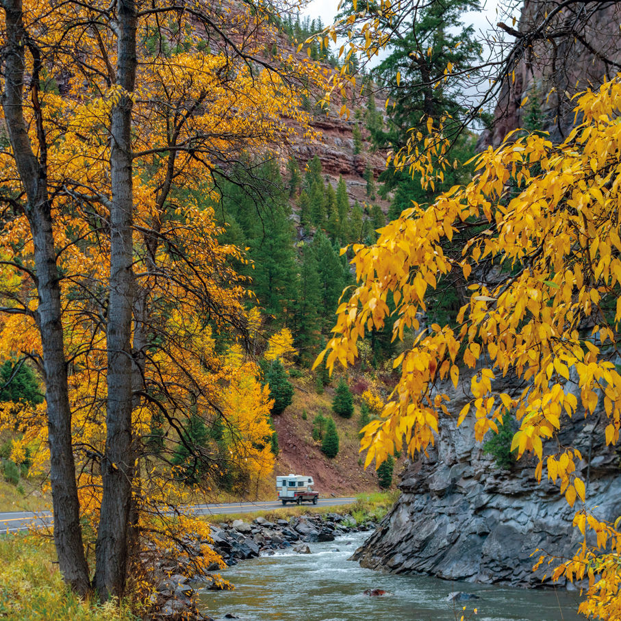
Head downvalley from Aspen on Highway 82 for 30 miles to Carbondale. As you turn left (south) on to Highway 133, the byway begins. Make sure to fuel up here if you’re low on gas and, while driving through Carbondale, take note of the intriguing statue by renowned artist James Surls in the town’s lone roundabout. For the next few miles, close-up views of 12,953-foot Mount Sopris dominate as you head up the Crystal River Valley toward Redstone, once a company town for a coal-mining operation and now an artists’ haven with its own castle (the former home of the company’s owner). If it’s a Sunday, pop in to the Redstone Inn (82 Redstone Blvd) for the brunch buffet.
From Redstone, follow Highway 133 up and over McClure Pass into the North Fork Valley, where the kind of fun-to-drive curvy road you see in car commercials offers up big views of the Ragged and West Elk mountains. Just past Paonia Reservoir, where County Road 12 intersects with Highway 133, will be the close of your loop tomorrow, but for now continue on past the coal mines of Somerset and Bowie to Paonia (also a Colorado Creative District), where you’ll find Big B’s Delicious Orchards (39126 Hwy 133), which offers lunchtime sandwiches from the café and locally grown fruit, veggies, juices, hard cider, and other products from the farm store. You can even pick your own fruit.
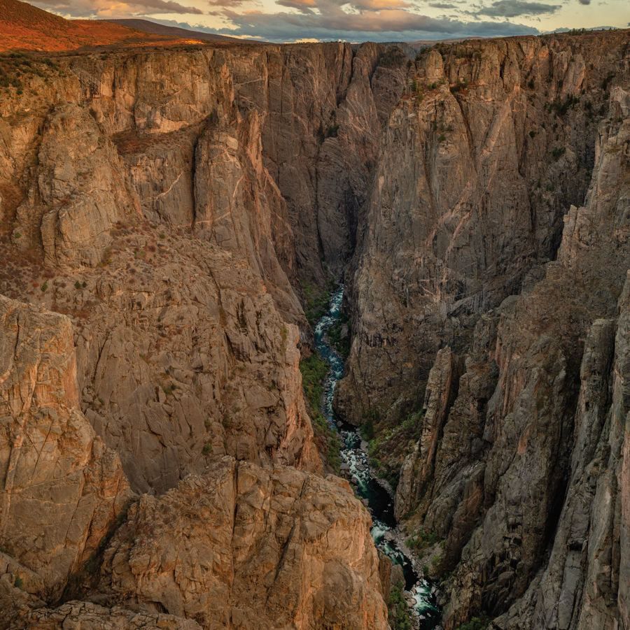
Continue southwest to the terminus of Highway 133 in the town of Hotchkiss and make a left on Highway 92 toward the town of Crawford. Just past Crawford State Park, turn right onto Black Canyon Road and follow the signs to Black Canyon of the Gunnison National Park, where the Gunnison River has carved a half-mile-deep cleft, with near-vertical walls, through the dark granite. For a short hike, try the mostly flat, 3.1-mile round-trip hike to dramatic Exclamation Point; otherwise, drive the North Rim Road, stopping at some of the six overlooks that offer views of features like Balanced Rock and Island Peaks.
After eventually backtracking to Highway 92, turn right onto the long and winding road that works its way along the canyon’s north rim past scenic overlooks like Hermit’s Rest and the spire-like Curecanti Needle. After crossing Blue Mesa Dam, turn left onto US Highway 50 and follow it as it traces the shoreline of 20-mile-long Blue Mesa Reservoir, the largest body of water in Colorado. A few miles past the reservoir, you’ll reach Gunnison, where the byway turns left onto Main Street (Highway 135). About 2 miles north of downtown, stop for a hearty dinner at Garlic Mike’s (2674 Hwy 135), which serves excellent Italian favorites like Mussels Posillipo and Lasagna Bolognese.
Crested Butte lies a half-hour drive north on Highway 135, where numerous lodging options (definitely book ahead) include the Lodge at Mountaineer Square (620 Gothic Rd), which offers family-size condos at the base of the ski area, and the Public House Lofts (202 Elk Ave), three luxe suites in a historic building in the heart of downtown.
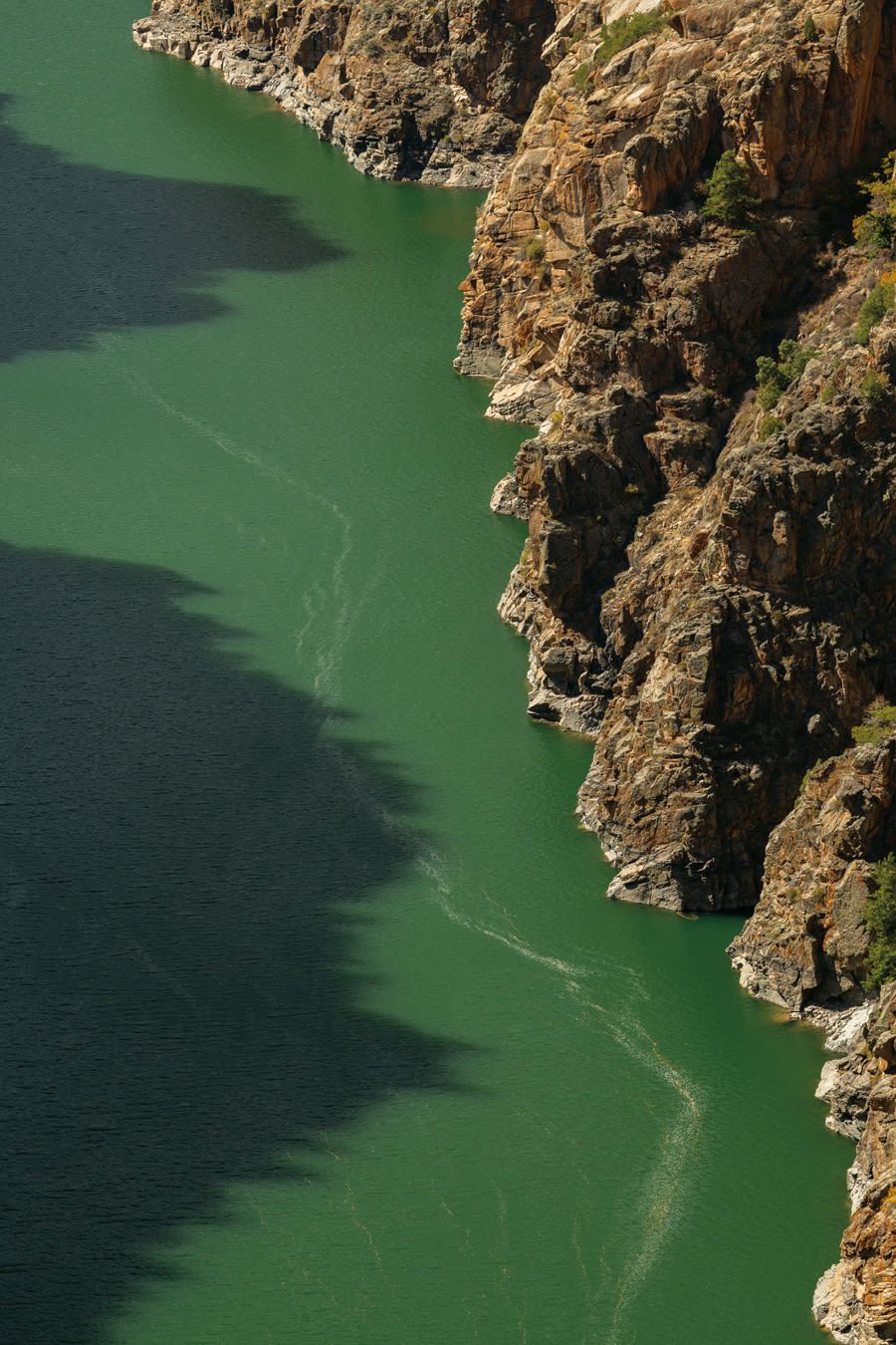
The mighty Gunnison River
Day 2
You did most of your driving yesterday, so take the morning easy and stroll around the shops and galleries of downtown Crested Butte, where you can grab breakfast at McGill’s (228 Elk Ave), with its highly recommended biscuits and gravy, or Izzy’s (218 Maroon Ave), a coffee shop tucked in an alley alongside Coal Creek serving bagels, egg dishes, and latkes. On Sundays, a small but vibrant farmers market takes over the west end of Elk Avenue (through Oct 6).
After breakfast, make the short drive (or take the free shuttle) up the hill to Crested Butte Mountain Resort, where several activities await. Younger kids will love the mini golf, rock climbing, bungee trampolines, and old-time panning sluice at the Summer Adventure Park, while teens and adults will thrill to the lift-served downhill and cross-country trails of the Crested Butte Mountain Bike Park and the five-station Zipline Tour. For a unique adventure, archers can take their bows and arrows to the top of the Red Lady Express lift for a course made up of 20 targets shaped like big game along a 1.5-mile loop trail.
Go back into Crested Butte for lunch at The Last Steep (208 Elk Ave), a local favorite offering burgers, wraps, and tacos. Then it’s back onto the byway, which heads west on Whiterock Avenue before turning into County Road 12 at the edge of town. Follow the graded gravel road (with a couple of short paved sections) over Kebler Pass and down the far side for a total of 16 miles to the intersection with Forest Service Road 706—when the large groves of aspen change color in mid- to late September, this part of the drive seems like heading through a blaze of gold. Turn left on 706 and drive 2 miles to Lost Lake Campground and the trailhead for the Three Lakes Trail, a 2.8-mile loop that takes in picturesque Lost Lake, Dollar Lake, and Lost Lake Slough. Even if you don’t make it around to all three lakes, hike a little ways past Lost Lake for a grand vista of the Ruby Range.
After hiking, head back to County Road 12 and turn left (west) to drive through even more aspens below the towering ramparts of Marcellina Mountain before the road ends in Highway 133, where your return route is to the right.
The loop is done, but you have one more stop. Back on the other side of McClure Pass, detour right on County Road 3 for 6 miles to the aptly named town of Marble. Take a short walk through the ruins of a fabricating mill where stone from a still-operating marble quarry was loaded on to railroad cars, bound for monuments like the Tomb of the Unknown Soldier and the Lincoln Memorial. Then get a table on the deck at Slow Groovin’ BBQ (101 W 1st St) and fill up on a platter of ribs or brisket before the drive back to Aspen.
The Book:
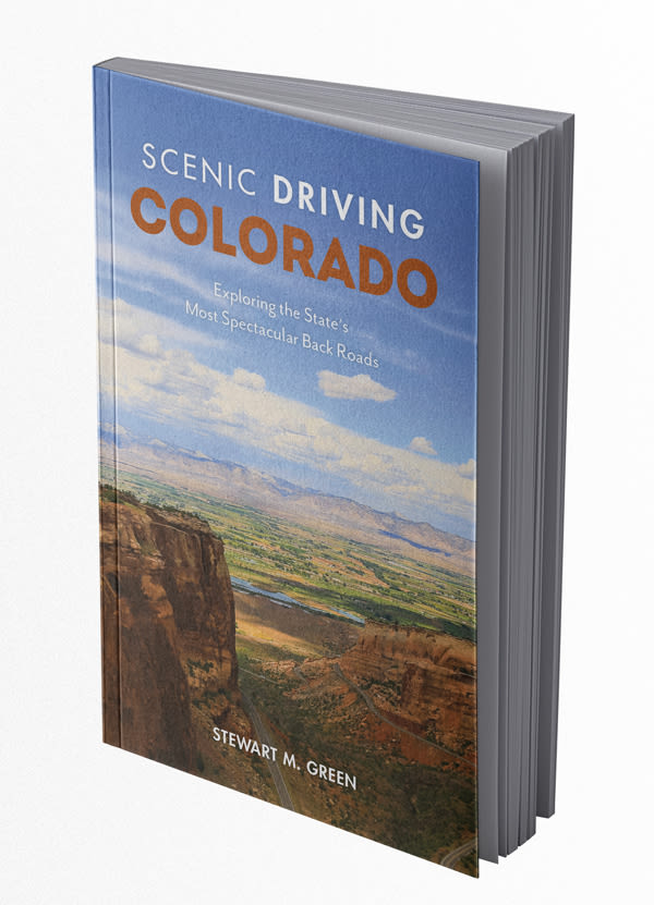
Scenic Driving Colorado: Exploring the State’s Most Spectacular Back Roads by Stewart M. Green
The just-released fifth edition of this well-researched guidebook details 30 routes throughout the state, highlighting historic sites, landmarks, natural features, and other points of interest that merit a stop along the way. $23.95 at Explore Booksellers
Road Trips
West Elk Loop Scenic Byway
Stake Out
Where to Camp Along Three Scenic Byways
Road Trips
Grand Mesa Scenic Byway


Aspen Snapshot
Returning to Barbie’s Dream House

Fun and Games
Aspenites Who’ve Made Their Mark at Winter Olympics

Local Love
Boogie by the Book


At Altitude
An Ecological Haven Gets a $9 Million Makeover
tweet this
A Birding Big Year in a Small Valley

Your Perfect Day
Where to Golf in the Roaring Fork Valley
Fun and Games
Aspenites Who’ve Made Their Mark at Winter Olympics

At Altitude
Bootpackers Share Favorite Highland Bowl Lines

Thrill List
The Ultimate Guide to Aspen Summer Adventures

Bottle Rocket
Colorado as a Hot Wine Destination?

Eat & Drink
Notable Restaurant Newcomers: Winter 2025-26

Restaurant Listings
Aspen Dining Guide

Feature
Dine Super Local in Aspen

Arts & Events
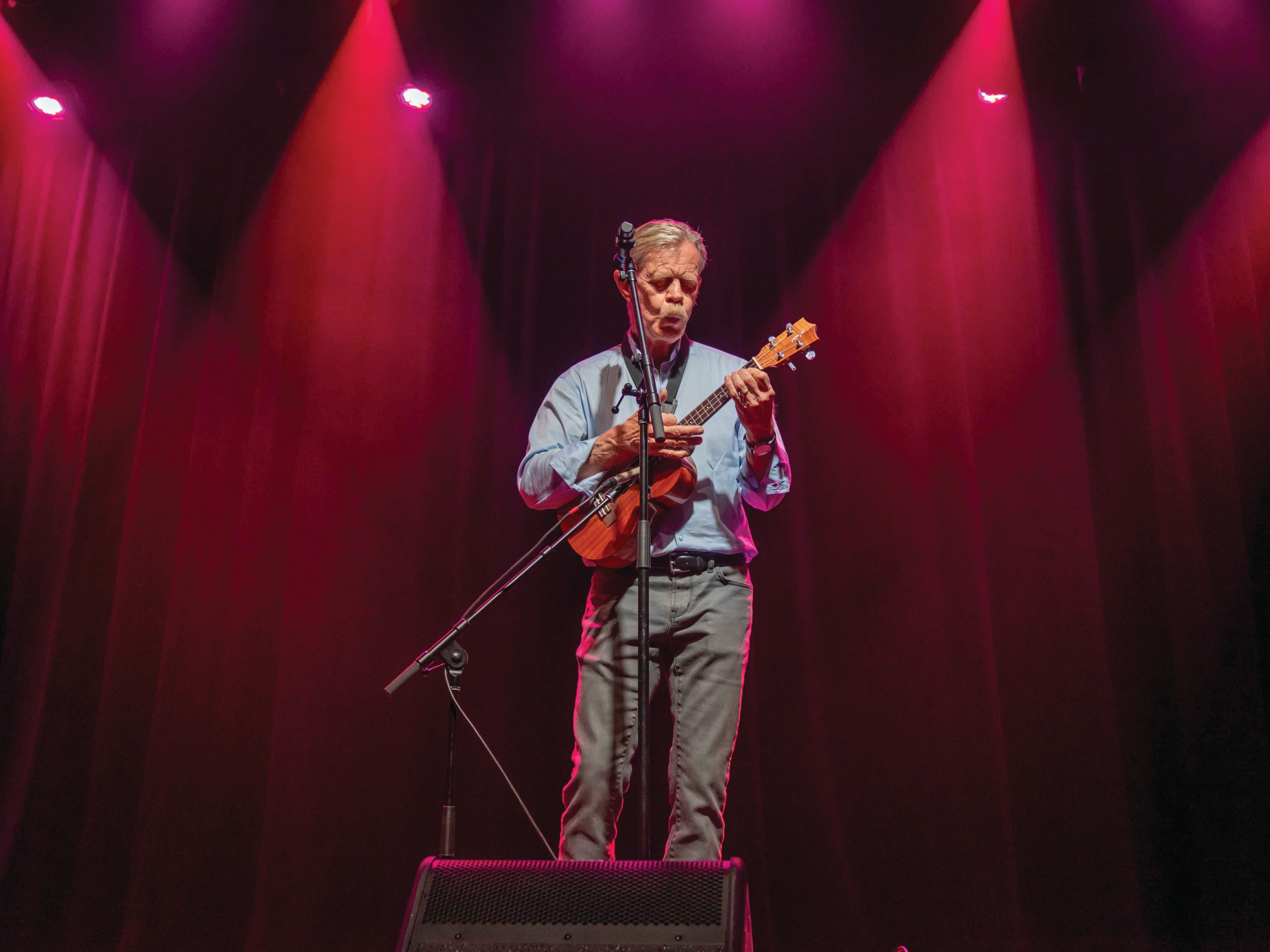
What to See: William H. Macy’s Variety Show at TACAW
At Altitude
An Ecological Haven Gets a $9 Million Makeover
Arts & Events
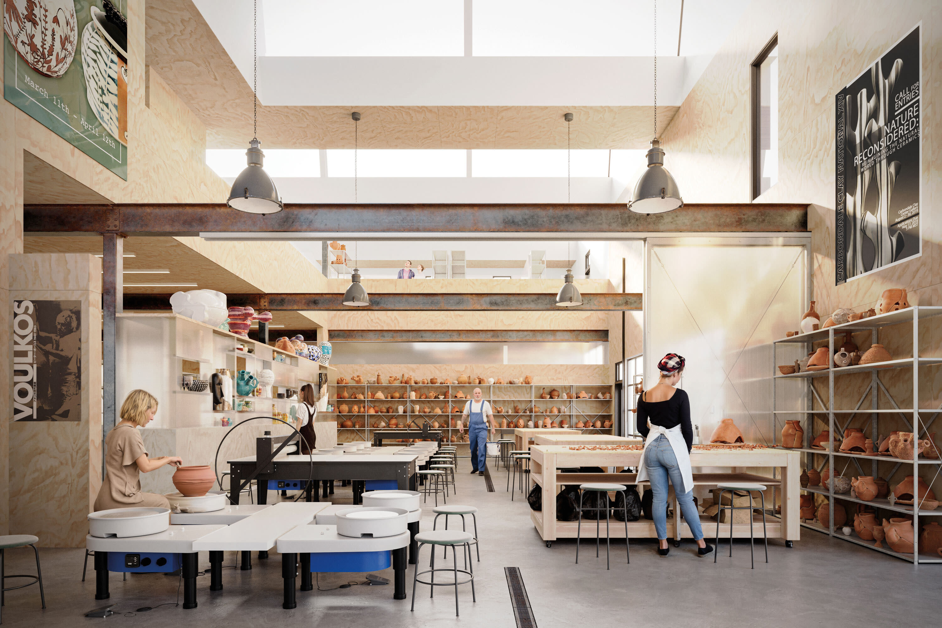
Envisioning a Bigger Space for Carbondale Clay Center
Arts & Events
Aspen’s Raizado Festival Returns for a Fourth Year
Mark Your Calendar
The Best of the Aspen Summer Scene

style roundup
Saddle Up Like an Aspen Cowgirl

Objects of Desire
20/20 Vision


Feature
Shop Super Local in Aspen

Fashion
Objects of Desire: Max Factor

Objects of Desire
Wild Style


Shelter
Reimagining a Home as Sculpture


rescue remedy
A Skin Care Must: Antedotum's New Face Oil

Bust a move
Aspen Fitness Three Ways

Retreat Yourself
Carbondale Wellness Sanctuary Is the Ultimate Winter Retreat

High Life
A Guide to Aspen's Dispensaries

Aspen Electric
A Guide to e-Biking in the Roaring Fork Valley

Etiquette Tips
E-Biking in the Roaring Fork Valley

A Night to Inspire
Ascendigo Blue Aspen 2020

People + Places
Pictures from the Winter Season’s Hottest Social Events

People + Places
Winter Fun Recap 2023-2024 Edition

People & Places
ASPENX Beach Club with Gray Malin

People & Places