Family-Friendly Hikes
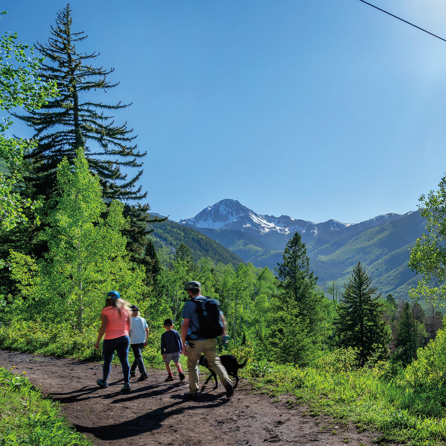
The Ditch Trail in Snowmass Village
LITTLE CLOUD
This hike gently climbs the lower reaches of Aspen Mountain through a pine forest, giving an overview of downtown. A series of short, moderately steep switchbacks leads to the intersection with Summer Road and a meadow often accented by wildflowers.
Length: 1.2 miles round-trip
Difficulty: Easy to moderate
Trailhead: Walk Durant Avenue west from downtown until it intersects with South Garmisch Street, and pick up the Midland Trail; the Little Cloud Trail will start soon on the left.
Good to know: In 1888, the Colorado Midland Railroad began running along what’s now the Midland Trail, transporting ore from the mines on Aspen Mountain.
WELLER LAKE
With minimal elevation gain and a lake at the end, this hike has a big payoff. The route threads through subalpine fir and Engelmann spruce before giving way to an aspen grove near the rocky lakeshore. While the trail ends here, the lake, situated below a cirque of craggy peaks, offers ample opportunities for exploration.
Length: 1.2 miles round-trip
Difficulty: Easy
Trailhead: Drive 9 miles east of Aspen on Highway 82. Trailhead parking is on the right (just before Weller Campground).
Good to know: Consider a side trip to the Grottos day-use area, less than a mile away, where a series of short trails leads to waterfalls, ice caves, and cool rock formations.
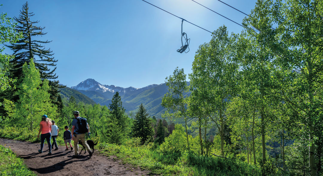
DITCH TRAIL
This mellow trail with outstanding views in Snowmass Village begins by traversing the lower slopes of Snowmass ski area, then parallels an old irrigation ditch through shady aspens. The farther you go, the bigger the views of Mount Daly and the Snowmass Creek Valley. Hike out and back as far as you want, or continue to the junction with the East Snowmass Creek Trail.
Length: Up to 3.2 miles round-trip
Difficulty: Easy
Trailhead: Drive Divide Road in Snowmass Village to Pinon Drive on the left; trailhead parking is on the right. Or hike up from the top of Carriage Way near the Snowmass Mall via Sleigh Ride Trail, about .75 miles each way.
Good to know: Those dogs you may hear howling at the trailhead? They belong to Krabloonik, the kennel across the road that offers dog-sled tours in winter.
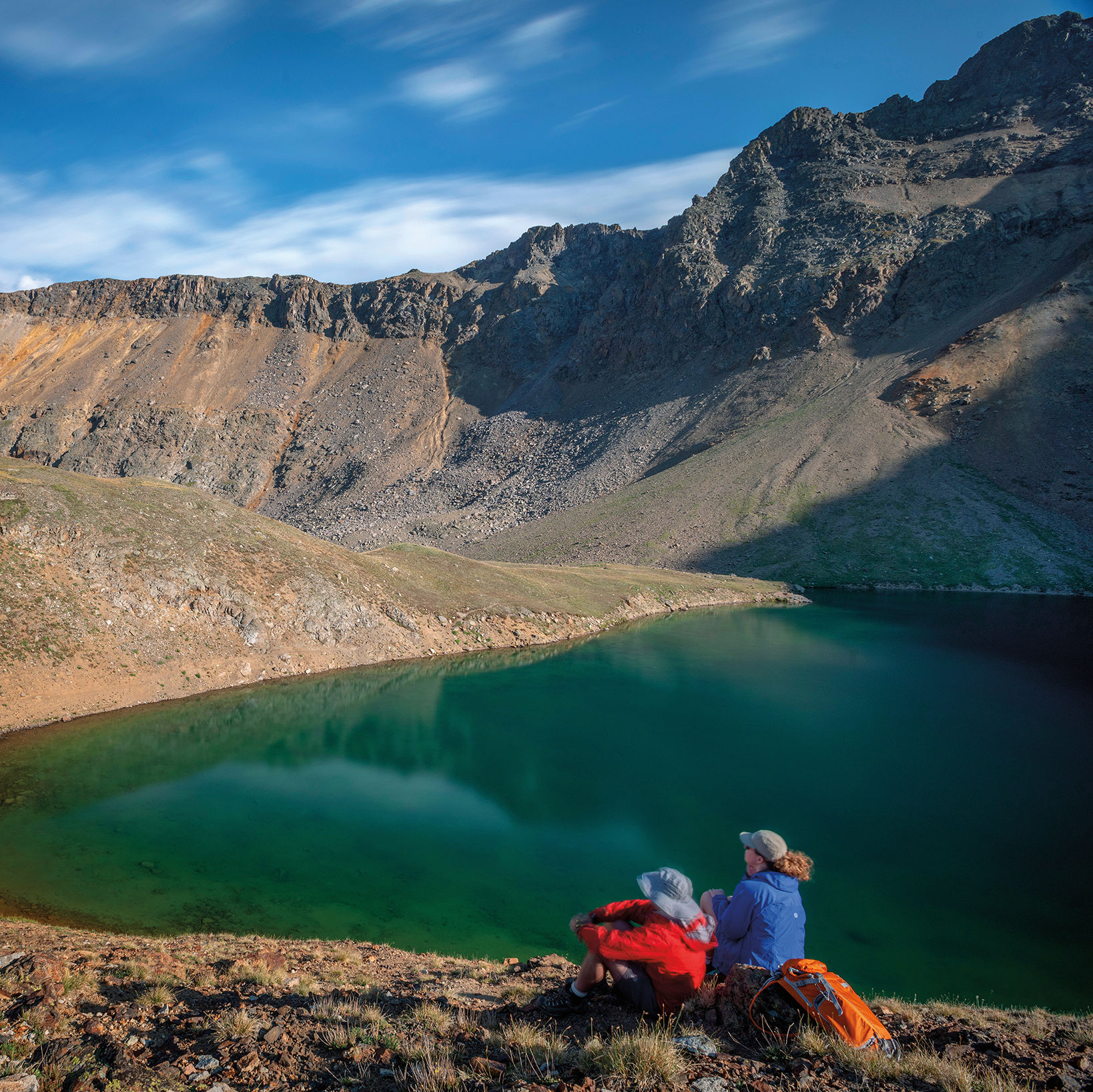
SAVAGE LAKES
With roughly 1,200 feet of elevation gain, this is a perfect day trip for more intrepid young hikers to a pair of high-alpine lakes. The rocky trail switchbacks, somewhat steeply at first, through dense spruce. Sounds of the creek accent the air as you pass the Holy Cross Wilderness boundary and the trail, now mellower, begins to follow the North Fork of the Fryingpan River. At approximately 1.6 miles, you’ll meet lake number one. Look for cairns on the left that mark the way to the upper lake. From here you can gaze at an amphitheater of 12,000-foot peaks, find a flat rock for picnicking, or fish.
Length: 4 miles round-trip
Difficulty: Moderate
Trailhead: Drive 22 miles from Basalt up Frying Pan Road to Meredith. About 3 miles farther, turn left on Forest Road 501. One mile after Elk Wallow Campground, take the left fork and drive 3.25 miles to the trailhead on the left. Park in the pullout on the right.
Good to know: Stop at the general store in Meredith for snacks pre- or post-hike.